Komemiyut
- This article is about the moshav. For the neighborhood of Jerusalem, see Talbiya.
| Komemiyut קוֹמְמִיּוּת | |
|---|---|
 | |
 Komemiyut | |
| Coordinates: 31°39′43.19″N 34°43′50.16″E / 31.6619972°N 34.7306000°ECoordinates: 31°39′43.19″N 34°43′50.16″E / 31.6619972°N 34.7306000°E | |
| District | Southern |
| Council | Shafir |
| Founded | 1950 |
| Founded by | Demobilised soldiers |
| Population (2017)[1] | 537 |
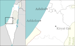
Komemiyut (Hebrew: קוֹמְמִיּוּת, eng. Erect) is an ultra-orthodox-Hasidic moshav in south-central Israel. Located in the southern Shephelah near Kiryat Gat, it falls under the jurisdiction of Shafir Regional Council. In 2017 it had a population of 537.[1]
History
The group which established the village was formed as a youth group by Agudat Israel in August 1949, composed mainly of demobilized soldiers from a religious unit that had fought in the area during the 1948 Arab–Israeli War.[2] The name is take from a biblical passage, Leviticus 26:13:[3] I broke the bars of your yoke and enabled you to walk erect.
After training in Nahalat Yehuda, the group founded the moshav in 1950 on land given to it by the Jewish National Fund.[4] The village was built over the depopulated Palestinian village of Karatiyya.[5]
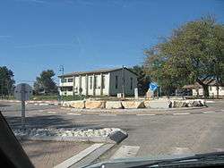
The moshav was built as an agricultural village, but to ensure a livelihood during the shmita year, industries were also established. The moshav has two bakeries including a matzo bakery, a dairy, a shingles factory, a marble factory, and a tefillin factory.[6][7][8] The moshav also has a program for yeshiva students, during which they study for six days and return to their homes only for shabbat and a Talmud Torah school for children.
References
| Wikimedia Commons has media related to Komemiyut. |
- 1 2 "List of localities, in Alphabetical order" (PDF). Israel Central Bureau of Statistics. Retrieved August 26, 2018.
- ↑ Carta's Official Guide to Israel and Complete Gazetteer to all Sites in the Holy Land. (3rd edition 1993) Jerusalem, Carta, pp.387–388, ISBN 965-220-186-3
- ↑ Carta, p.387
- ↑ http://jpress.org.il/Olive/APA/NLI_Heb/SharedView.Article.aspx?parm=CzRg1ZXxmnsNeV487qhwru60Ta4Z7obwcmzMh1x4mVDVAq8ETu%2BMn8lWonvObbokYw%3D%3D&mode=image&href=DAV%2f1949%2f05%2f02&page=4&rtl=true
- ↑ Khalidi, Walid (1992). All That Remains: The Palestinian Villages Occupied and Depopulated by Israel in 1948. Washington D.C.: Institute for Palestine Studies. p. 119. ISBN 0-88728-224-5. ISBN 0-88728-224-5.
- ↑ http://jpress.org.il/Olive/APA/NLI_Heb/SharedView.Article.aspx?parm=LBIAAaURQHJ3RbhMhR9ZNSBxT72KTv6goJFqD8Is%2B%2F0OaoQrdKL%2FOCYBQJTpQmPlYw%3D%3D&mode=image&href=HZH%2f1953%2f12%2f14&page=4&rtl=true
- ↑ http://jpress.org.il/Olive/APA/NLI_Heb/SharedView.Article.aspx?parm=4ytfdhHSD0PRUQl%2FVdEqeEUgyNw9oRY5AgMBzVJLYLlvI4x28Wx8gV3qAaO6ktASYw%3D%3D&mode=image&href=DAV%2f1952%2f09%2f12&page=12&rtl=true
- ↑ http://jpress.org.il/Olive/APA/NLI_Heb/SharedView.Article.aspx?parm=0wrBjcC3LYbX1bDtwy7y8k8oMqDHrQFQJAxiCherlksZxYRAJV30TrE9msyoQgZWYw%3D%3D&mode=image&href=DAV%2f1959%2f04%2f24&page=8&rtl=true