Kollweiler
| Kollweiler | ||
|---|---|---|
| ||
 Kollweiler Location of Kollweiler within Kaiserslautern district 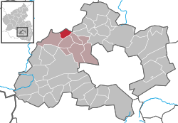 | ||
| Coordinates: 49°30′57″N 7°35′04″E / 49.51583°N 7.58444°ECoordinates: 49°30′57″N 7°35′04″E / 49.51583°N 7.58444°E | ||
| Country | Germany | |
| State | Rhineland-Palatinate | |
| District | Kaiserslautern | |
| Municipal assoc. | Weilerbach | |
| Government | ||
| • Mayor | Hartmut Schmitt (SPD) | |
| Area | ||
| • Total | 5.57 km2 (2.15 sq mi) | |
| Elevation | 335 m (1,099 ft) | |
| Population (2017-12-31)[1] | ||
| • Total | 501 | |
| • Density | 90/km2 (230/sq mi) | |
| Time zone | CET/CEST (UTC+1/+2) | |
| Postal codes | 66879 | |
| Dialling codes | 06385 | |
| Vehicle registration | KL | |

Kollweiler is a municipality in the district of Kaiserslautern, in Rhineland-Palatinate, western Germany.
Geography
Kollweiler lies in the Northern Pfalz. To the north are the towns of Jettenbach and Rothselberg, and to the south are the towns of Schwedelbach and Reichenbach-Steegen. The closest city is Kaiserslautern, located 15 km to the southeast.
History
Even before the Romans, Celtic descendants settled the area around Kollweiler.
References
- ↑ Statistisches Landesamt Rheinland-Pfalz "Bevölkerungsstand 2017 - Gemeindeebene" Check
|url=value (help). Statistisches Landesamt Rheinland-Pfalz (in German). 2018.
This article is issued from
Wikipedia.
The text is licensed under Creative Commons - Attribution - Sharealike.
Additional terms may apply for the media files.