Eulenbis
| Eulenbis | ||
|---|---|---|
| ||
 Eulenbis Location of Eulenbis within Kaiserslautern district 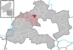 | ||
| Coordinates: 49°30′27″N 7°38′08″E / 49.50750°N 7.63556°ECoordinates: 49°30′27″N 7°38′08″E / 49.50750°N 7.63556°E | ||
| Country | Germany | |
| State | Rhineland-Palatinate | |
| District | Kaiserslautern | |
| Municipal assoc. | Weilerbach | |
| Government | ||
| • Mayor | Manfred Bügner | |
| Area | ||
| • Total | 3.97 km2 (1.53 sq mi) | |
| Elevation | 385 m (1,263 ft) | |
| Population (2017-12-31)[1] | ||
| • Total | 487 | |
| • Density | 120/km2 (320/sq mi) | |
| Time zone | CET/CEST (UTC+1/+2) | |
| Postal codes | 67685 | |
| Dialling codes | 06374 | |
| Vehicle registration | KL | |
| Website | www.eulenbis.de | |

Eulenbis is a municipality in the district of Kaiserslautern, in Rhineland-Palatinate, western Germany.
Geography
Eulenbis lies around 13 kilometers northwest of Kaiserslautern. The Eulenkopf to the west has a height of 422 meters, and Eulenbis is the highest part of the greater Weilerbach community.
History
The first documented mention of the town as Ulengebeiß dates back to the year 1380.
Politics
Town Council
The Eulenbis town council consists of twelve members who were last elected in 2009. The council is headed up by a volunteer mayor. [2]
Coat of Arms
Emblazoning: "In Gold auf gewölbtem grünem Boden eine goldbewehrte schwarze Eule".
Culture and Notable Sights
Economy and Infrastructure
Transportation
- The community is connected to the Autobahn network through the A6 Autobahn.
References
- ↑ Statistisches Landesamt Rheinland-Pfalz "Bevölkerungsstand 2017 - Gemeindeebene" Check
|url=value (help). Statistisches Landesamt Rheinland-Pfalz (in German). 2018. - ↑ Der Landeswahlleiter Rheinland-Pfalz: Kommunalwahl 2009, Stadt- und Gemeinderatswahlen
- Gerold Scheuermann: Eulenbis. (Hrsg.: Ortsgemeinde Eulenbis), Ortsgemeinde Eulenbis, Eulenbis 1985
This article is issued from
Wikipedia.
The text is licensed under Creative Commons - Attribution - Sharealike.
Additional terms may apply for the media files.