Kolymvari
| Kolymvari Κολυμβάρι | |
|---|---|
 Kolymvari Location within the regional unit 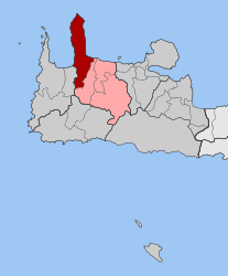 | |
| Coordinates: 35°32′N 23°47′E / 35.533°N 23.783°ECoordinates: 35°32′N 23°47′E / 35.533°N 23.783°E | |
| Country | Greece |
| Administrative region | Crete |
| Regional unit | Chania |
| Municipality | Platanias |
| • Municipal unit | 150.0 km2 (57.9 sq mi) |
| Population (2011)[1] | |
| • Municipal unit | 4,457 |
| • Municipal unit density | 30/km2 (77/sq mi) |
| Community[1] | |
| • Population | 1,109 (2011) |
| Time zone | UTC+2 (EET) |
| • Summer (DST) | UTC+3 (EEST) |
| Postal code | 730 06 |
| Area code(s) | 28240 |
| Vehicle registration | ΧΝ, XB |
| Website | Kolymvari Website |
Kolymvari (Greek: Κολυμβάρι, Δήμος Κολυμβαρίου), also known as Kolymbari (Greek: Κολυμπάρι), is a town and former municipality in the Chania regional unit, Crete, Greece. Since the 2011 local government reform it is part of the municipality Platanias, of which it is a municipal unit.[2] The municipal unit has an area of 149.994 km2 (57.913 sq mi).[3] It was part of the former Kissamos province which covered the northwest of Chania Prefecture.
Kolymvari is a working coastal town at the southern end of the Rodopou peninsula and is a local centre for commerce and fishing. It does not have a sandy beach and is thus not as popular with tourists as the nearby resorts of Maleme and Platanias. Near the town is the historic Moni Gonia Monastery. The Spiliakos river enters the sea at Kolymvari. The municipal unit of Kolymvari covers the Rodopou peninsula at the end of the Gulf of Chania and some villages to the south. Most of the peninsula is uninhabited and rather barren, with most villages close to Kolymvari at the southern end. The municipal unit also includes Rodopou, Afrata, Vasilopoulo, Spilia, Kares, Episkopi, Vouves, Glossa, Panethimos, Nochia, Deliana, Drakona, Ravdouchas, Kalidonia, and Kamisiana.
See also
References
- 1 2 "Απογραφή Πληθυσμού - Κατοικιών 2011. ΜΟΝΙΜΟΣ Πληθυσμός" (in Greek). Hellenic Statistical Authority.
- ↑ Kallikratis law Greece Ministry of Interior (in Greek)
- ↑ "Population & housing census 2001 (incl. area and average elevation)" (PDF) (in Greek). National Statistical Service of Greece. Archived from the original (PDF) on 2015-09-21.