Kolbingen
| Kolbingen | ||
|---|---|---|
| ||
 Kolbingen Location of Kolbingen within Tuttlingen district 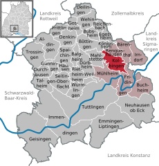  | ||
| Coordinates: 48°03′08″N 08°53′20″E / 48.05222°N 8.88889°ECoordinates: 48°03′08″N 08°53′20″E / 48.05222°N 8.88889°E | ||
| Country | Germany | |
| State | Baden-Württemberg | |
| Admin. region | Freiburg | |
| District | Tuttlingen | |
| Government | ||
| • Mayor | Konstantin Braun | |
| Area | ||
| • Total | 16.49 km2 (6.37 sq mi) | |
| Elevation | 854 m (2,802 ft) | |
| Population (2017-12-31)[1] | ||
| • Total | 1,250 | |
| • Density | 76/km2 (200/sq mi) | |
| Time zone | CET/CEST (UTC+1/+2) | |
| Postal codes | 78600 | |
| Dialling codes | 07463 | |
| Vehicle registration | TUT | |
| Website | www.kolbingen.de | |

Kolbingen is a town in the district of Tuttlingen in Baden-Württemberg in Germany. It is situated about 15 km northeast of Tuttlingen and 7 km from Mühlheim an der Donau.
Farming
To help people to help themselves Württemberg plant alley of fruit-trees.(Dienstbarkeit on private ground near streets). The tree farms from William I of Württemberg, also the Brüdergemeinde delivered for free.[2] The Kolbinger Goldbirne is a local tree.
References
- ↑ "Bevölkerung nach Nationalität und Geschlecht am 31. Dezember 2017". Statistisches Landesamt Baden-Württemberg (in German). 2018.
- ↑ Apfelgeschichte auf Apfelgut Sulz
External links
- Official Web site for the city of Kolbingen (in German)
This article is issued from
Wikipedia.
The text is licensed under Creative Commons - Attribution - Sharealike.
Additional terms may apply for the media files.