Böttingen
| Böttingen | ||
|---|---|---|
| ||
 Böttingen Location of Böttingen within Tuttlingen district 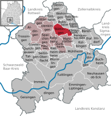  | ||
| Coordinates: 48°06′02″N 08°48′17″E / 48.10056°N 8.80472°ECoordinates: 48°06′02″N 08°48′17″E / 48.10056°N 8.80472°E | ||
| Country | Germany | |
| State | Baden-Württemberg | |
| Admin. region | Freiburg | |
| District | Tuttlingen | |
| Government | ||
| • Mayor | Gerhard Minder (CDU) | |
| Area | ||
| • Total | 16.31 km2 (6.30 sq mi) | |
| Elevation | 915 m (3,002 ft) | |
| Population (2017-12-31)[1] | ||
| • Total | 1,424 | |
| • Density | 87/km2 (230/sq mi) | |
| Time zone | CET/CEST (UTC+1/+2) | |
| Postal codes | 78583 | |
| Dialling codes | 07429 | |
| Vehicle registration | TUT | |
| Website | www.boettingen.de | |

Böttingen is a municipality in the district of Tuttlingen in Baden-Württemberg in Germany. In recent decades it has developed from an agricultural village to an advanced industrial community.
Geography
Böttingen sits on a plateau in the southwestern Swabian Jura in a long dry valley. At an elevation of 911 to 991 meters it was the highest village in the historical Kingdom of Württemberg.
The municipality borders Gosheim to the north, Bubsheim to the northeast, Königsheim to the east, Mahlstetten and Dürbheim to the south, and Balgheim and Denkingen to the West.
The municipality Böttingen consists of the village Böttingen and the Gehöft Allenspacher manor, as well as the abandoned villages Leineburg and Windingen.
History
The first written mention of Böttingen was in 802 and contained a land title grant by the Abbey of Saint Gall. Celtic and Alemanni grave finds as well as flint axes in a cave indicate an earlier Stone Age settlement. After 1253 the territory paid tribute and received protection from the Beuron Archabbey, after a change of ownership the Bishopric of Constance, and then the Herren von Enzberg, until it became part of Württemberg in 1805. The village had to pay interest and tithe as well as socage until 1848.
Politics
The community belongs to the Amt Spaichingen.
Sights
- The old mountain landmark (980 meters above sea level) has a view over the preserved natural landscape of the southwest Swabian Alb as well as a chapel.
- 60 km-long cross-country skiing trail network on the plateau
- Posted hiking trails
Notable residents
- Bernard Häring, Catholic theologian
- Margret Marquart, theologian and missionary doctor in Uganda and Ghana (died 2004)
References
- ↑ "Bevölkerung nach Nationalität und Geschlecht am 31. Dezember 2017". Statistisches Landesamt Baden-Württemberg (in German). 2018.
| Authority control |
|---|