Zarghun Ghar
Coordinates: 30°07′N 67°48′E / 30.117°N 67.800°E
| Zarghun Ghar | |
|---|---|
| Highest point | |
| Elevation | 3,578 m (11,739 ft) [1] |
| Geography | |
| Location | Pakistan |
Zarghun Ghar (Pashto: زرغون غر, lit. "Green Mountain"), or Zarghoon Mountains, is a mountain range located in the east of Quetta District, in Balochistan Province, western Pakistan.
Peaks
The Zarghun Ghar range's highest peak is Loy Saar Naikan, at 3,578 meters (11738. ft), while the second highest peak is Kuchnai Saar, at 3,404 meters (11,170. ft). At 3,578 metres (11,739 ft), The "Loy Saar Naikan" of the Zarghun Ghar mountain range is the highest peak of Baluchistan.[2]
Flora
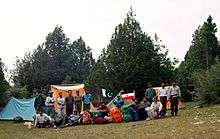
The base of the Zarghoon Ghar up to Ziarat is densely covered by Pashtun Juniper (Juniperus macropoda) trees, a forest of about 200,000 acres (810 km2). The Pashtun Juniper forest in the adjacent Ziarat District, which covers an area of about 247,000 acres (1,000 km2), is known as the second largest Juniper forest in the world.The beautiful and scenic base of Zarghoon is "shabaan' natural grassy park with two cool water streams covered by beautiful juniper trees is very attractive as camping site for climbers and hikers.
Wildlife
Zarghoon mountain has wild animals living freely in the mountains, the wild animals have reported including Jackals, Rabbits, Wolf and Fox buck, one of extinct animals had once been reported was Cheetah.
See also
References
- ↑ "Highest Mountains Peak in Baluchistan and Quetta". Chiltan Adventures Association Balochistan.com. Retrieved 27 September 2010.
- ↑ http://www.caab.20m.com%7CChiltan Adventurers Association Balochistan