Koetong
| Koetong Victoria | |
|---|---|
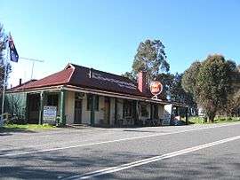 The Koetong Pub on the Murray Valley Highway | |
 Koetong Location in Shire of Towong, Victoria | |
| Coordinates | 36°09′S 147°30′E / 36.150°S 147.500°ECoordinates: 36°09′S 147°30′E / 36.150°S 147.500°E |
| Postcode(s) | 3704 |
| Location |
|
| LGA(s) | Shire of Towong |
| State electorate(s) | Benambra |
| Federal Division(s) | Indi |
Koetong is a locality in north-east Victoria, Australia. The locality, part of the Towong Shire local government area, is on the Murray Valley Highway between Tallangatta and Corryong, 394 kilometres (245 mi) north-east of the state capital, Melbourne, .
Koetong was surveyed in 1885 but not proclaimed until 1952.[1] Tin and gold mining has been sporadically carried out in the area since 1873.[2]
The local state school first opened in 1890 and after several temporary closures, closed permanently in 2003.[1] The town is an access point to nearby Mount Lawson State Park.[3]
References
- 1 2 "Koetong". Towns and Localities: Shire of Towong. RootsWeb. Retrieved 17 August 2010.
- ↑ Annear, Robyn. "Koetong Tin Field" (PDF). Heritage Victoria. Archived from the original (PDF) on 29 September 2009. Retrieved 17 August 2010.
- ↑ "Koetong". Towns and villages. Towong Shire Council. Archived from the original on 17 February 2011. Retrieved 17 August 2010.
See also
This article is issued from
Wikipedia.
The text is licensed under Creative Commons - Attribution - Sharealike.
Additional terms may apply for the media files.