Berringama
| Berringama Victoria | |
|---|---|
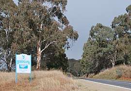 Entering Berringama along the Murray Valley Highway | |
 Berringama | |
| Coordinates | 36°13′02″S 147°39′10″E / 36.21722°S 147.65278°ECoordinates: 36°13′02″S 147°39′10″E / 36.21722°S 147.65278°E |
| Population | 37 (2016 census)[1] |
| Postcode(s) | 3691 |
| Location | |
| LGA(s) | Shire of Towong |
| State electorate(s) | Benambra |
| Federal Division(s) | Indi |
Berringama is a locality in north east Victoria, Australia. The locality is in the Shire of Towong local government area, 418 kilometres (260 mi) north east of the state capital, Melbourne.
At the 2016 census, Berringama had a population of 37.[1]
References
- 1 2 Australian Bureau of Statistics (27 June 2017). "Berringama". 2016 Census QuickStats. Retrieved 26 July 2017.

External links
![]()
This article is issued from
Wikipedia.
The text is licensed under Creative Commons - Attribution - Sharealike.
Additional terms may apply for the media files.