Klondike Fire
| Klondike Fire | |
|---|---|
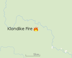
| Location | Siskiyou National Forest, Oregon, United States |
| Coordinates | 42°22′08″N 123°51′36″W / 42.369°N 123.86°WCoordinates: 42°22′08″N 123°51′36″W / 42.369°N 123.86°W |
| Statistics[1] | |
| Cost | Unknown |
| Date(s) | July 15, 2018 – |
| Burned area | 130,258 acres (52,714 ha) |
| Cause | Lightning |
| Buildings destroyed | 0 |
| Map | |
 Location of fire in Oregon. | |
 |
| Location of Klondike Fire |
The Klondike Fire is an ongoing wildfire in the U.S. state of Oregon. The fire had burned more than 130,258 acres (527 km2) and was 51% contained as of September 9th, 2018[2]. InciWeb predicts it may take until October 31, 2018 to fully contain the fire. Part of the fire has merged with the nearby Taylor Creek Fire, which as of September 8th, 2018 had burned 52,839 acres (214 km2) and was 95% contained.
Fire growth and containment progress
| Date | Area burned acres (km2) | Containment | ||
|---|---|---|---|---|
| Aug 7 | 28,746 (116) | 5%
| ||
| Aug 8 | 35,072 (142) | 15%
| ||
| Aug 9 | 36,876 (149) | 15%
| ||
| Aug 10 | 38,382 (155) | 15%
| ||
| Aug 11 | 47,030 (190) | 15%
| ||
| Aug 12 | 51,120 (207) | 15%
| ||
| Aug 13 | 55,248 (224) | 15%
| ||
| Aug 14 | 55,248 (224) | 15%
| ||
| Aug 15 | 57,325 (232) | 15%
| ||
| Aug 16 | 59,015 (239) | 15%
| ||
| Aug 17 | 62,731 (254) | 15%
| ||
| Aug 18 | 66,332 (268) | 15%
| ||
| Aug 19 | 68,241 (276) | 15%
| ||
| Aug 20 | 72,074 (292) | 28%
| ||
| Aug 21 | 76,098 (308) | 32%
| ||
| Aug 22 | 76,098 (308) | 33%
| ||
| Aug 23 | 79,501 (322) | 37%
| ||
| Sep 9 | 130,258 (527) | 51%
|
References
- ↑ "Klondike Fire". InciWeb. US Forest Service. Retrieved 4 June 2018.
- ↑ helpdesk@dms.nwcg.gov, InciWeb developed and maintained by USDA Forest Service, Fire and Aviation Management,. "Klondike Fire Information - InciWeb the Incident Information System". inciweb.nwcg.gov. Retrieved 2018-08-07.
This article is issued from
Wikipedia.
The text is licensed under Creative Commons - Attribution - Sharealike.
Additional terms may apply for the media files.