Klepp stasjon
| Klepp Stasjon Klepp | |
|---|---|
| Village | |
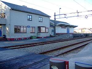 View of the village railway station | |
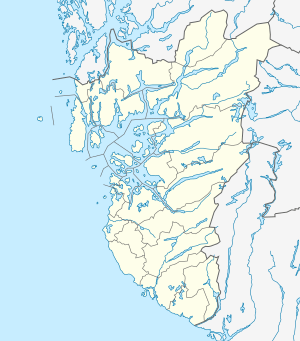 Klepp Stasjon Location in Rogaland county  Klepp Stasjon Klepp Stasjon (Norway) | |
| Coordinates: 58°46′22″N 05°40′38″E / 58.77278°N 5.67722°ECoordinates: 58°46′22″N 05°40′38″E / 58.77278°N 5.67722°E | |
| Country | Norway |
| Region | Western Norway |
| County | Rogaland |
| District | Jæren |
| Municipality | Klepp |
| Elevation[1] | 30 m (100 ft) |
| Time zone | UTC+01:00 (CET) |
| • Summer (DST) | UTC+02:00 (CEST) |
| Post Code | 4353 Klepp stasjon |
Klepp Stasjon is a village in Klepp municipality in Rogaland county, Norway. The village is located on the shore of the lake Frøylandsvatnet, about 3 kilometres (1.9 mi) east of the village of Kleppe and about 2 kilometres (1.2 mi) southwest of the village of Orstad. The village is named after the Klepp Station, a station on the Jæren railway line.
History
When the Jæren Line was constructed in 1878, the village of Kleppe was somewhat offset from the convenient path of the railway, so the railway station serving Kleppe was placed 3 kilometres (1.9 mi) east of the village rather than in the village. After the station was built, the village of Klepp Stasjon (literally Klepp Station) grew up around the railway station.
References
- ↑ "Klepp, Klepp (Rogaland)" (in Norwegian). yr.no. Retrieved 2016-05-26.
This article is issued from
Wikipedia.
The text is licensed under Creative Commons - Attribution - Sharealike.
Additional terms may apply for the media files.