Kleine Steinau
| Kleine Steinau | |
|---|---|
 | |
| Location |
Göttingen district in Lower Saxony, |
| Physical characteristics | |
| Main source |
Between Schindelkopf and Spießerklippe on the Acker 690 m above sea level 51°43′02″N 10°21′05″E / 51.7171°N 10.3515°E |
| River mouth |
Near Aschenhütte into the Sieber 210 m above sea level 51°40′26″N 10°18′06″E / 51.6740°N 10.3018°ECoordinates: 51°40′26″N 10°18′06″E / 51.6740°N 10.3018°E |
| Length | 9.1 km (5.7 mi) [1] |
| Basin features | |
| Progression | Sieber→ Oder→ Rhume→ Leine→ Aller→ Weser→ North Sea |
| Tributaries |
|
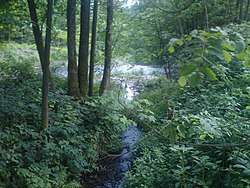
The Kleine Steinau is a 9.1 km long tributary of the Sieber, north of Herzberg am Harz in the district of Göttingen in Lower Saxony. It rises at about 690 metres between the Schindelkopf mountain and the Spießerklippe crags on the ridge of Auf dem Acker. It initially flows in a westerly direction, but later swings south before emptying into the River Sieber near the small settlement of Aschenhütte, not far from the mouth of the Große Steinau. In the upper reaches of the Kleine Steinau it is also called the Schindelgraben, although it is not clear from the maps at which point the name changes.
Sources
- Topographische Karte 1:25000, Nr. 4228 Riefensbeek
- Topographische Karte 1:25000, Nr. 4227 Osterode im Harz
- Topographische Karte 1:25000, Nr. 4327 Gieboldehausen
References
This article is issued from
Wikipedia.
The text is licensed under Creative Commons - Attribution - Sharealike.
Additional terms may apply for the media files.