Kitzscher
| Kitzscher | ||
|---|---|---|
| ||
 Kitzscher Location of Kitzscher within Leipzig district 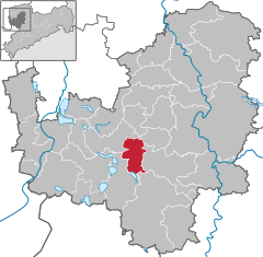  | ||
| Coordinates: 51°9′52.11″N 12°33′12.60″E / 51.1644750°N 12.5535000°ECoordinates: 51°9′52.11″N 12°33′12.60″E / 51.1644750°N 12.5535000°E | ||
| Country | Germany | |
| State | Saxony | |
| District | Leipzig | |
| Government | ||
| • Mayor | Maik Schramm (FW) | |
| Area | ||
| • Total | 28.99 km2 (11.19 sq mi) | |
| Elevation | 100 m (300 ft) | |
| Population (2017-12-31)[1] | ||
| • Total | 4,895 | |
| • Density | 170/km2 (440/sq mi) | |
| Time zone | CET/CEST (UTC+1/+2) | |
| Postal codes | 04567 | |
| Dialling codes | 03433 | |
| Vehicle registration | L | |
| Website | www.kitzscher.de | |

Kitzscher is a town in the Leipzig district, in the Free State of Saxony, Germany.
Geography
Kitzscher is situated in the Leipziger Tieflandsbucht, at the perimeter of the Central Saxon Hills. The town is situated 6 km northeast of Borna, and 24 km southeast of Leipzig. A nearby slagheap from open cast mining called the 'Halde Trages' is one of the highest points in the vicinity and the main sight of interest in the locality.
Neighboring parishes
Places adjacent to Kitzscher | ||||||||||
|---|---|---|---|---|---|---|---|---|---|---|
| ||||||||||
History
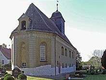
The little church in Kitzscher
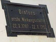
Plaque on the church school in memory of Dinter
The village was first mentioned in a charter document in the abbey at Grimma in the year 1251 which referred to a noble family, Guntherus de Kiczschere, which ultimately died out in 1676 .
The oldest structure in the town is the church the origins of which date back to 1200.
References
- ↑ "Aktuelle Einwohnerzahlen nach Gemeinden 2017] (Einwohnerzahlen auf Grundlage des Zensus 2011)" (PDF). Statistisches Landesamt des Freistaates Sachsen (in German). October 2018.
Towns and municipalities in Leipzig (district) | ||
|---|---|---|
This article is issued from
Wikipedia.
The text is licensed under Creative Commons - Attribution - Sharealike.
Additional terms may apply for the media files.