Kittle, Arkansas
| Kittle, Arkansas | |
|---|---|
| Unincorporated community | |
 Kittle, Arkansas  Kittle, Arkansas | |
| Coordinates: 36°16′0″N 91°37′42″W / 36.26667°N 91.62833°WCoordinates: 36°16′0″N 91°37′42″W / 36.26667°N 91.62833°W | |
| Country | United States |
| State | Arkansas |
| County | Fulton |
| Township | Pleasant Ridge |
| Elevation | 755 ft (230 m) |
| Time zone | UTC-6 (Central (CST)) |
| • Summer (DST) | UTC-5 (CDT) |
| Area code(s) | 870 |
| GNIS feature ID | 58023[1] |
Kittle is an unincorporated community in southeastern Fulton County, Arkansas, United States.[1] The community is located on Arkansas Highway 289, just north of U.S. Route 412. The west end of the Cherokee Village is just to the northeast.[2]
References
- 1 2 "Kittle". Geographic Names Information System. United States Geological Survey.
- ↑ Arkansas Atlas and Gazetteer, DeLorme, 2nd edition 2002, page = 27 ISBN 0-89933-345-1
Municipalities and communities of Fulton County, Arkansas, United States | ||
|---|---|---|
| Cities | 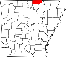 | |
| Town | ||
| Unincorporated communities | ||
| Footnotes | ‡This populated place also has portions in an adjacent county or counties | |
This article is issued from
Wikipedia.
The text is licensed under Creative Commons - Attribution - Sharealike.
Additional terms may apply for the media files.