Kisoga, Gomba
| Kisoga, Gomba | |
|---|---|
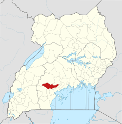
 Kisoga, Gomba Map of Uganda showing the location of Kisoga, Gomba | |
| Coordinates: 00°11′55″N 31°57′01″E / 0.19861°N 31.95028°E | |
| Country |
|
| Region | Central Uganda |
| District | Gomba District |
| Elevation | 1,199 m (3,934 ft) |
| Time zone | UTC+3 (EAT) |
Kisoga is a settlement in Central Uganda. It is a suburb of the town of Kanoni, the administrative, commercial and political headquarters of Gomba District.[1]
Location
Kisoga is situated approximately 9 kilometres (6 mi), northeast of Kanoni, the location of the district headquarters.[2] This location is approximately 96 kilometres (60 mi), by road, west of Kampala, the capital of Uganda and the largest city in that country.[3] The coordinates of Kisoga, Gomba are:0°11'55.0"N, 31°57'01.0"E (Latitude:0.198611; Longitude:31.950278).[4]
See also
References
- ↑ Mukiibi, Eriasa S. (25 August 2010). "The Making of A Needy District". The Independent (Uganda). Kampala. Archived from the original on 11 July 2015. Retrieved 20 July 2015.
- ↑ GFC, . (20 July 2015). "Map Showing Kisoga, Gomba And Kanoni With Route Marker". Globefeed.com (GFC). Retrieved 20 July 2015.
- ↑ GFC, . (20 July 2015). "Road Distance Between Kampala And Kisoga, Gomba With Interactive Map". Globefeed.com (GFC). Retrieved 20 July 2015.
- ↑ Google (20 July 2015). "Location of Kisoga, Gomba At Google Maps" (Map). Google Maps. Google. Retrieved 20 July 2015.
External links
Coordinates: 00°11′55″N 31°57′01″E / 0.19861°N 31.95028°E
Capital: Kanoni | ||
| Towns and villages |
|  |
| Economy |
| |
| Energy | ||
| Health |
| |
| Transport | ||
| Notable people | ||
This article is issued from
Wikipedia.
The text is licensed under Creative Commons - Attribution - Sharealike.
Additional terms may apply for the media files.