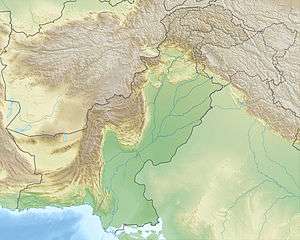
Kirthar Mountains
| Kirthar Mountains Darihyaro (Dogs Grave) thumb | |
|---|---|
| Arbiti Mountains[1] | |
 Kirthar Mountains Darihyaro (Dogs Grave)
thumb Karakh, Balochistan | |
| Highest point | |
| Elevation | 2,151 m (7,057 ft) |
| Coordinates | 27°00′00″N 67°09′20″E / 27.0000°N 67.1556°ECoordinates: 27°00′00″N 67°09′20″E / 27.0000°N 67.1556°E |
| Naming | |
| Native name |
کير ٿر جبل كوه کیر تھر |
| Geography | |
| Location | Karakh, Balochistan |
The Kirthar Mountains (Urdu: كوه کھیرتھر) (Sindhi: کير ٿر جبل) are a mountain range located in the Pakistani provinces of Balochistan and Sindh.[2] The mountains extend southward for about 190 mi (310 km) from the Mula River in east-central Balochistan to Cape Monze on the Arabian Sea. The Kirthar Mountains form the boundary between the lower Indus Plain (to the east) and southern Balochistan (to the west). It consists of a series of parallel rock hill ridges rising from 4,000 ft (1,200 m) in the south to nearly 8,000 ft (2,400 m) in the north.[3]
The maximum elevation in the Sindh segment of the mountains was reported in April 2009, as 7,056 ft (2,151 m) above sea-level. An old map, by the British Army Corps of Engineers, calls it Barugh Hill, along with a surveyed height of 7,122 ft (2,171 m). Barugh, means "big fat mountain" in the Brahui language, the language of the Sasoli tribe, who still live in that area. Barough is a branch of the Kirthar mountains, off Dadu, and the highest mountain peak of Sindh, situated a few miles north-west of the upcoming Gorakh Hill Station, at 5,688 ft (1,734 m) from sea level. The next highest is a 6,880-foot-high (2,100 m) peak, known locally as Kutte-Ji-Kabar (Dog's Grave) which is placed in Darhiyaro Balochistan. There are also a number of other peaks in the Sindh segment of the Kirthar Mountains exceeding 5,500 ft (1,700 m); these all receive occasional snowfall during the winter rains.
According to Balochistan 1907 Volume VI-B Jhalawan, this area belongs to Balochistan. That, from the top of the Kuchak-na-Kabar (6,878 fed) which rises from the high table-land of Darhiyaro., a good view of the surrounding country is obtained, the hills beyond the valley of Karkh or Karu being visible, as well as the verdant bed of the Gaaj river. Another important peak is Andraj (6,4')6 feet to the south-east of Zidi. To the south the mountains decrease in size, the Bedor hill, not however situated in the Jhalawan, being only 3,320 feet above sea level. There are a good many passes in the range which are passable by camels, but the only ones which are much used are the Gaji Lak on the road from Zidi and Khuzdar to Jhalawan. The history also said the land of Darhiyaro. belongs to Chhutta tribe.
Regrading the communities which are and were settled in Darhiyaro they wrote "Dr. J. Ph. Vogel published in 1905 an interesting note on the Ancient tombs at Hin£dan in Las Bela. Attention to these tombs was first drawn by Major M.A. Tighe, Political Agent in Southern Baluchistan, and the locality was subsequently visited by Dr. Vogel Binfdan. The tombs, 71 in number, are situated in the area of the Chhuttas and the local tradition ascribes the origin of the place to Chhutto and Jakharas, now settled in Sindh, who are a subdivision of the Burfat tribe, which is believed to be of Rajput origin."
Kirthar has a simple mountain structure of the regular anticlinal type, with the arches steepest towards the north and the west and gently dipping towards the south and the valley of the Darhiyaro. The inhabitants of the Kirthar Mountains are chiefly Chhutto people of Bhootani tribe, Sindhi and Balochi tribes, on both sides, who subsist by flock grazing. Major Baloch tribes of Kirthar are Chhutta, Burfat, Gabol, Marri, Bozdar, Lund, Nohani, Bugti, Chandio, Lashari, and others.
Gallery
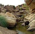 Cold water spring in the Kirthar National Park
 Chinkara gazelle in the Kirthar Mountains
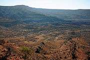 Another view of the Kirthar National Park
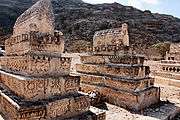 The Taung Tombs
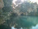 Spring of Piprasar in Kirthar Mountain
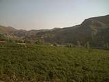 Agricultural vale in Kirthar Mountain
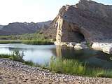 A cave near water spring in Kirthar Mountain
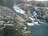 Water fall in the Kirthar Mountain
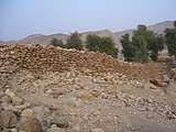 A wall of oldest fort in the Kirthar Mountain
 A kind of flowery plant in Kirthar mountain
_plant_in_Kirthar_Mountain.jpg) Senwar (in Sindhi) plant in Kirthar Mountain
Senwar (in Sindhi) plant in Kirthar Mountain A thorny plant in Kirthar Mountain
See also
References
- ↑ Arbita or Arbitani according to Ptolemy, named after a local tribe, the Arabitae
- ↑ ".:: Wildlife of Pakistan ::". www.wildlife.pk.
- ↑ "Kirthar Range - mountain region, Pakistan".