Kirchheilingen
| Kirchheilingen | |
|---|---|
 Kirchheilingen Location of Kirchheilingen within Unstrut-Hainich-Kreis district 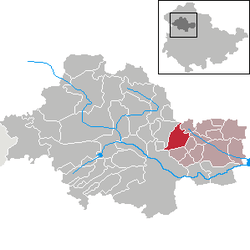 | |
| Coordinates: 51°10′59″N 10°41′59″E / 51.18306°N 10.69972°ECoordinates: 51°10′59″N 10°41′59″E / 51.18306°N 10.69972°E | |
| Country | Germany |
| State | Thuringia |
| District | Unstrut-Hainich-Kreis |
| Municipal assoc. | Bad Tennstedt |
| Government | |
| • Mayor | Jan Behner |
| Area | |
| • Total | 16.51 km2 (6.37 sq mi) |
| Elevation | 250 m (820 ft) |
| Population (2017-12-31)[1] | |
| • Total | 803 |
| • Density | 49/km2 (130/sq mi) |
| Time zone | CET/CEST (UTC+1/+2) |
| Postal codes | 99947 |
| Dialling codes | 036043 |
| Vehicle registration | UH |
| Website | www.kirchheilingen.com |
Kirchheilingen is a municipality in the Unstrut-Hainich district of Thuringia, Germany.
References
This article is issued from
Wikipedia.
The text is licensed under Creative Commons - Attribution - Sharealike.
Additional terms may apply for the media files.