Körner, Germany
| Körner | ||
|---|---|---|
| ||
 Körner Location of Körner within Unstrut-Hainich-Kreis district 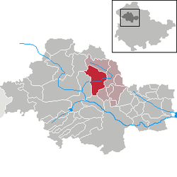 | ||
| Coordinates: 51°13′52″N 10°35′15″E / 51.23111°N 10.58750°ECoordinates: 51°13′52″N 10°35′15″E / 51.23111°N 10.58750°E | ||
| Country | Germany | |
| State | Thuringia | |
| District | Unstrut-Hainich-Kreis | |
| Municipal assoc. | Schlotheim | |
| Government | ||
| • Mayor | Eberhard Kunde | |
| Area | ||
| • Total | 30.64 km2 (11.83 sq mi) | |
| Elevation | 208 m (682 ft) | |
| Population (2017-12-31)[1] | ||
| • Total | 1,671 | |
| • Density | 55/km2 (140/sq mi) | |
| Time zone | CET/CEST (UTC+1/+2) | |
| Postal codes | 99998 | |
| Dialling codes | 036025 | |
| Vehicle registration | UH | |
| Website | www.koerner-volkenroda.de | |

Körner is a municipality in the Unstrut-Hainich district of Thuringia, Germany.
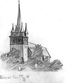
Church St. Wigberti at Körner (1915)
History
Within the German Empire (1871-1945), Körner was part of the Duchy of Saxe-Coburg and Gotha.
References
This article is issued from
Wikipedia.
The text is licensed under Creative Commons - Attribution - Sharealike.
Additional terms may apply for the media files.