Kinoguitan, Misamis Oriental
| Kinoguitan | ||
|---|---|---|
| Municipality | ||
| Municipality of Kinoguitan | ||
| ||
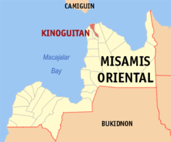 Map of Misamis Oriental with Kinoguitan highlighted | ||
.svg.png) Kinoguitan Location within the Philippines | ||
| Coordinates: 8°59′N 124°49′E / 8.98°N 124.82°ECoordinates: 8°59′N 124°49′E / 8.98°N 124.82°E | ||
| Country |
| |
| Region | Northern Mindanao (Region X) | |
| Province | Misamis Oriental | |
| District | 1st District | |
| Founded | June 22, 1929 (Executive Order No. 178, s. 1929) | |
| Barangays | 15 (see Barangays) | |
| Government [1] | ||
| • Type | Sangguniang Bayan | |
| • Mayor | Danilo A. Lagbas Jr. | |
| • Electorate | 10,181 voters (2016) | |
| Area [2] | ||
| • Total | 42.56 km2 (16.43 sq mi) | |
| Population (2015 census)[3] | ||
| • Total | 14,391 | |
| • Density | 340/km2 (880/sq mi) | |
| Time zone | UTC+8 (PST) | |
| ZIP code | 9010 | |
| PSGC | 104312000 | |
| IDD : area code | +63 (0)88 | |
| Climate type | Tropical climate | |
| Income class | 5th municipal income class | |
| Revenue (₱) | 49,435,321.11 (2016) | |
| Native languages |
Cebuano Binukid Subanon language Tagalog | |
| Website |
www | |

Kinoguitan, officially the Municipality of Kinoguitan, is a 5th class municipality in the province of Misamis Oriental, Philippines. According to the 2015 census, it has a population of 14,391 people.[3]
The town name Kinoguitan is spelled by the old folks especially during the early 1950s as Kinogitan.
Barangays
Kinoguitan is politically subdivided into 15 barangays.
- Beray
- Bolisong
- Buko
- Kalitian
- Calubo
- Campo
- Esperanza
- Kagumahan
- Kitotok
- Panabol
- Poblacion
- Salicapawan
- Salubsob
- Suarez
- Sumalag
Demographics
| Population census of Kinoguitan | |||||||||||||||||||||||||||||||||||||||||||
|---|---|---|---|---|---|---|---|---|---|---|---|---|---|---|---|---|---|---|---|---|---|---|---|---|---|---|---|---|---|---|---|---|---|---|---|---|---|---|---|---|---|---|---|
|
| ||||||||||||||||||||||||||||||||||||||||||
| Source: Philippine Statistics Authority[3][4][5][6] | |||||||||||||||||||||||||||||||||||||||||||
In the 2015 census, the population of Kinoguitan was 14,391 people,[3] with a density of 340 inhabitants per square kilometre or 880 inhabitants per square mile.
References
- ↑ "Municipality". Quezon City, Philippines: Department of the Interior and Local Government. Retrieved 31 May 2013.
- ↑ "Province: Misamis Oriental". PSGC Interactive. Quezon City, Philippines: Philippine Statistics Authority. Retrieved 12 November 2016.
- 1 2 3 4 Census of Population (2015). "Region X (Northern Mindanao)". Total Population by Province, City, Municipality and Barangay. PSA. Retrieved 20 June 2016.
- ↑ Census of Population and Housing (2010). "Region X (Northern Mindanao)". Total Population by Province, City, Municipality and Barangay. NSO. Retrieved 29 June 2016.
- ↑ Censuses of Population (1903–2007). "Region X (Northern Mindanao)". Table 1. Population Enumerated in Various Censuses by Province/Highly Urbanized City: 1903 to 2007. NSO.
- ↑ "Province of Misamis Oriental". Municipality Population Data. Local Water Utilities Administration Research Division. Retrieved 17 December 2016.
External links
- Philippine Standard Geographic Code
- Philippine Census Information
- Local Governance Performance Management System
Places adjacent to Kinoguitan, Misamis Oriental | |
|---|---|
Cagayan de Oro (capital) | |
| Municipalities | |
| Component cities | |
| Highly urbanized city |
|
This article is issued from
Wikipedia.
The text is licensed under Creative Commons - Attribution - Sharealike.
Additional terms may apply for the media files.