Kingston, Milton Keynes
| Kingston | |
|---|---|
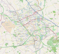 Kingston Mapping © OpenStreetMap 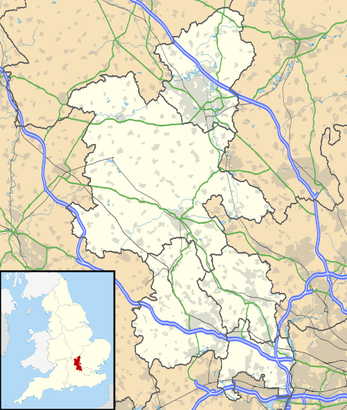 Kingston Kingston shown within Buckinghamshire | |
| OS grid reference | SP905385 |
| Civil parish |
|
| Unitary authority | |
| Ceremonial county | |
| Region | |
| Country | England |
| Sovereign state | United Kingdom |
| Post town | MILTON KEYNES |
| Postcode district | MK10 |
| Dialling code | 01908 |
| Police | Thames Valley |
| Fire | Buckinghamshire |
| Ambulance | South Central |
| EU Parliament | South East England |
| UK Parliament | |
Kingston is a district in the east side of Milton Keynes, in the civil parish of Kents Hill, Monkston and Brinklow.
Kingston District Centre is a large retail development that serves this side of Milton Keynes (its home parish, Broughton, Middleton, the parish of Walton, and Newport Pagnell). The District Centre houses a Tesco hypermarket and other UK high street names, such as Boots, Marks and Spencer and other retail outlets. The centre also has a small local library and a meeting place.
According to Milton Keynes Borough Council, Kingston, Wolverton, Bletchley and Westcroft form the second tier in the retail hierarchy of Milton Keynes, below Central Milton Keynes.[1]
Bounded by Chafron Way (H7) to the north, Tongwell St (A4146) to the east, Standing Way (A421) to the south and Newport Rd (A5130) to the east, the rest of the district consists of a motor dealer, light industry factories and warehouses.
References
External links