King Philip's Hill
|
King Philip's Hill | |
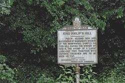 Historic marker describing the hill | |
  | |
| Location | Off Old Bernardston Rd., Northfield, Massachusetts |
|---|---|
| Coordinates | 42°41′2″N 72°28′35″W / 42.68389°N 72.47639°WCoordinates: 42°41′2″N 72°28′35″W / 42.68389°N 72.47639°W |
| Built | 1675 |
| NRHP reference # | 81000106[1] |
| Added to NRHP | December 16, 1981 |
King Philip's Hill is a historic site off Old Bernardston Road in Northfield, Massachusetts. In 1675 the Wampanoag chief Metacom, also called "King Philip" by English colonists, is said to have held council here during King Philip's War. The hill has evidence of what appear to be trenches and other remnants of fortification from the time, but the exact nature of these is debatable; 19th century area historian George Sheldon believed the trenches to be the work of a colonist.[2]
The site added to the National Register of Historic Places in 1981.[1] It is now owned by the town, and there is a trail that loops around and over the hill, with informational signs along the way.[3]
See also
References
- 1 2 National Park Service (2008-04-15). "National Register Information System". National Register of Historic Places. National Park Service.
- ↑ Tougias, Michael; Schultz, Eric (2000-12-01). King Philip's War. ISBN 9781581577013.
- ↑ "King Philip's Hill Trail". Town of Northfield. Retrieved 2018-07-11.
| Topics |  | ||||||||||||||||
|---|---|---|---|---|---|---|---|---|---|---|---|---|---|---|---|---|---|
| Lists by county | |||||||||||||||||
| Lists by city |
| ||||||||||||||||
| Other lists | |||||||||||||||||
| |||||||||||||||||
This article is issued from
Wikipedia.
The text is licensed under Creative Commons - Attribution - Sharealike.
Additional terms may apply for the media files.