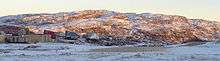
Kimmirut Airport
| Kimmirut Airport | |||||||||||
|---|---|---|---|---|---|---|---|---|---|---|---|
 | |||||||||||
| Summary | |||||||||||
| Airport type | Public | ||||||||||
| Operator | Government of Nunavut | ||||||||||
| Location | Kimmirut | ||||||||||
| Time zone | EST (UTC−05:00) | ||||||||||
| • Summer (DST) | EDT (UTC−04:00) | ||||||||||
| Elevation AMSL | 169 ft / 52 m | ||||||||||
| Coordinates | 62°50′53″N 069°52′38″W / 62.84806°N 69.87722°WCoordinates: 62°50′53″N 069°52′38″W / 62.84806°N 69.87722°W | ||||||||||
| Map | |||||||||||
 CYLC Location in Nunavut | |||||||||||
| Runways | |||||||||||
| |||||||||||
| Statistics (2010) | |||||||||||
| |||||||||||
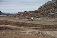
Kimmirut Airport (IATA: YLC, ICAO: CYLC) is located at Kimmirut, Nunavut, Canada, and is operated by the Government of Nunavut. Unlike most airports in Nunavut, it uses magnetic headings for the runway rather than true headings.
At 1,899 ft (579 m) the Kimmirut airstrip is the second shortest in Nunavut. Formerly Arctic Bay Airport at 1,500 ft (457 m) was the shortest, but in 2010 the runway was extended to 3,935 ft (1,199 m).[1]
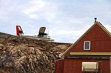
The Grise Fiord airstrip is just slightly shorter than Kimmirut at 1,675 ft (511 m).[1] The length of the runway and challenging terrain at both Kimmirut and Grise Fiord limit the type of aircraft that can service those communities. Currently, both are served by airlines operating Twin Otter aircraft.
Airlines and destinations
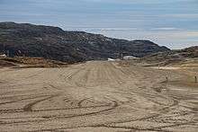
Threshold of runway 16
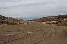
Threshold of runway 34
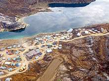
Overhead Kimmirut airport
| Airlines | Destinations |
|---|---|
| First Air | Iqaluit[3] |
Twin Otter landing runway 34
Twin Otter just landing on runway 34
References
- 1 2 3 Canada Flight Supplement. Effective 0901Z 19 July 2018 to 0901Z 13 September 2018.
- ↑ Total aircraft movements by class of operation
- ↑ First Air schedule
- Aeronautical Information Manual Transport Canada publication TP 14371E
- Designated Airspace Handbook, Transport Canada
External links
- Past three hours METARs, SPECI and current TAFs for Kimmirut Airport from Nav Canada as available.
- Website with local Kimmirut/CYLC information
- Detailed current Kimmirut weather info
| By name | |
|---|---|
| By location indicator | |
| By province/territory | |
| By area | |
| National Airports System | |
| Related | |
| |
This article is issued from
Wikipedia.
The text is licensed under Creative Commons - Attribution - Sharealike.
Additional terms may apply for the media files.