Khok Salut
| Khok Salut โคกสลุด | |
|---|---|
| Tambon | |
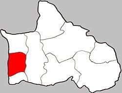 Location of Khok Salut within Amphoe | |
| Coordinates: 16°33′30″N 100°15′00″E / 16.55833°N 100.25000°ECoordinates: 16°33′30″N 100°15′00″E / 16.55833°N 100.25000°E | |
| Country | Thailand |
| Province | Phitsanulok |
| Amphoe | Bang Krathum |
| Population (2005) | |
| • Total | 3,342 |
| Time zone | UTC+7 (ICT) |
| Postal code | 65110 |
| Geocode | 650503 |
| Chief roadway | Route 1063 |
| Chief watercourse | Nan River |
Khok Salut (Thai: โคกสลุด) is a subdistrict (tambon) in the Bang Krathum district of Phitsanulok Province, Thailand.
Geography
Khok Salut is bounded to the north by Ban Rai, to the east by Bang Krathum, to the south by Sanam Khli, and to the west by Phichit Province. Most of Khok Salut lies within the Nan Basin, although a narrow strip of land on the west side of the subdistrict lies within the Yom Basin. Both basins are part of the Chao Phraya Watershed. The Nan River flows through Khok Salut.
Administration
The subdistrict is subdivided into 10 smaller divisions called (muban), which roughly correspond to the villages in Khok Salut. There are six villages, several of which occupy multiple muban. Khok Salut is administered by a tambon administrative organization (TAO). The muban in Khok Salut are enumerated as follows: [1]
| No. | English | Thai |
| 1-5 | Ban Yan Yao | บ้านย่านยาว |
| 6 | Ban Chong Tai | บ้านโฉงใต้ |
| 7 | Ban Chong Glang | บ้านโฉงกลาง |
| 8 | Ban Yung Kao | บ้านยุ้งข้าว |
| 9 | Ban Wang Tabua | บ้านวังตาบัว |
| 10 | Ban Hua Thanon | บ้านหัวถนน |
Temples
Khok Salut is home to the following four temples:[2]
- วัดราษฎร์เจริญ in Ban Chong Glang
- Wat Kam Paeng Manee (Thai: วัดกำแพงมณี) in Ban Chong Tai
- Wat Prasat Satta (Thai: วัดประสาทศรัทธา, Temple of Bestowed Faith) in Ban Yan Yao
- Wat Yan Yao (Thai: วัดย่านยาว, Temple of Vast Expanse) in Ban Yan Yao
References
- ↑ Khok Salut at Pitlocal.org (Thai)
- ↑ Khok Salut on WebWat.com Archived 2007-09-03 at the Wayback Machine.