Hkamti, Myanmar
| Hkamti Khamti, Kanti | |
|---|---|
| Town | |
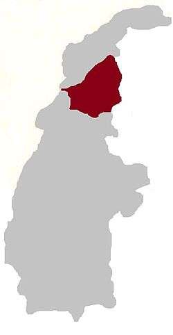
 Hkamti Location in Burma | |
| Coordinates: 26°00′06″N 95°41′32″E / 26.00167°N 95.69222°ECoordinates: 26°00′06″N 95°41′32″E / 26.00167°N 95.69222°E | |
| Country |
|
| Region |
|
| District | Hkamti District |
| Township | Hkamti Township |
| Time zone | UTC+6.30 (MST) |
Khamti, Hkamti, Singkawng, Kanti[1] or Kantee[2] is a town in Hkamti District, Sagaing Division, in north-western Myanmar. It is the administrative center for both the district and Hkamti Township (Khamti Township).
Its airport[2] is known as Khamti Airport.
Although Hkamti is often called Khamti (Hkamti), there is also a village about two miles to the west that is called "Hkampti".
Notes
- ↑ "Burma: Second-Order Administrative Divisions (Districts)" The Permanent Committee of Geographic Names (PCGN), United Kingdom, page 3, from Internet Archive of 25 September 2007
- 1 2 "Map of Sagaing Division" Archived 28 March 2010 at the Wayback Machine. Myanmar's NET, accessed 8 October 2009
External links


This article is issued from
Wikipedia.
The text is licensed under Creative Commons - Attribution - Sharealike.
Additional terms may apply for the media files.