Kham Sakaesaeng District
| Kham Sakaesaeng ขามสะแกแสง | |
|---|---|
| Amphoe | |
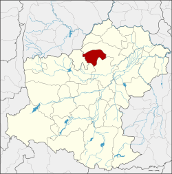 Amphoe location in Nakhon Ratchasima Province | |
| Coordinates: 15°19′46″N 102°10′15″E / 15.32944°N 102.17083°ECoordinates: 15°19′46″N 102°10′15″E / 15.32944°N 102.17083°E | |
| Country | Thailand |
| Province | Nakhon Ratchasima |
| Seat | Kham Sakaesaeng |
| Area | |
| • Total | 298.0 km2 (115.1 sq mi) |
| Population (2000) | |
| • Total | 43,365 |
| • Density | 145.5/km2 (377/sq mi) |
| Time zone | UTC+7 (ICT) |
| Postal code | 30290 |
| Geocode | 3011 |
Kham Sakaesaeng (Thai: ขามสะแกแสง, pronounced [kʰǎːm sā.kɛ̄ː.sɛ̌ːŋ]) is a district (amphoe) in the northern part of Nakhon Ratchasima Province, northeastern Thailand.
History
The government separated the two tambons Kham Sakaesaeng and Mueang Nat from Non Sung District and created the minor district (king amphoe) Kham Sakaesaeng on 25 November 1968.[1] It was upgraded to a full district on 28 June 1973.[2]
Geography
Neighboring districts are (from the north clockwise) Khong, Non Sung, Non Thai, and Phra Thong Kham.
Administration
The district is divided into seven sub-districts (tambon). There two townships (thesaban tambon) within the district: Kham Sakae Saeng covers part of tambon Kham Sakae Saeng and Nong Hua Fan covers parts of tambons Nong Hua Fan and Mueang Nat.
| 1. | Kham Sakaesaeng | ขามสะแกแสง | |
| 2. | Non Mueang | โนนเมือง | |
| 3. | Mueang Nat | เมืองนาท | |
| 4. | Chiwuek | ชีวึก | |
| 5. | Pha-ngat | พะงาด | |
| 6. | Nong Hua Fan | หนองหัวฟาน | |
| 7. | Mueang Kaset | เมืองเกษตร |
References
- ↑ ประกาศกระทรวงมหาดไทย เรื่อง แบ่งท้องที่ตั้งเป็นกิ่งอำเภอ (PDF). Royal Gazette (in Thai). 85 (115 ง): 3335. December 3, 1968.
- ↑ พระราชกฤษฎีกาตั้งอำเภอเขาพนม อำเภอสนามชัยเขต อำเภอแม่อาย อำเภอขามสะแกแสง อำเภอเก้าเลี้ยว อำเภอโพธิ์ประทับช้าง อำเภอหนองพอก อำเภอละอุ่น อำเภอทุ่งหว้า และอำเภอศรีธาตุ พ.ศ. ๒๕๑๖ (PDF). Royal Gazette (in Thai). 90 (75 ก special): 32–36. June 28, 1973.
External links
This article is issued from
Wikipedia.
The text is licensed under Creative Commons - Attribution - Sharealike.
Additional terms may apply for the media files.