Sung Noen District
| Sung Noen สูงเนิน | |
|---|---|
| Amphoe | |
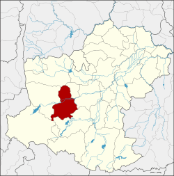 Amphoe location in Nakhon Ratchasima Province | |
| Coordinates: 14°54′0″N 101°49′18″E / 14.90000°N 101.82167°ECoordinates: 14°54′0″N 101°49′18″E / 14.90000°N 101.82167°E | |
| Country | Thailand |
| Province | Nakhon Ratchasima |
| Seat | Sung Noen |
| Area | |
| • Total | 782.9 km2 (302.3 sq mi) |
| Population (2014) | |
| • Total | 82,383 |
| • Density | 97.1/km2 (251/sq mi) |
| Time zone | UTC+7 (ICT) |
| Postal code | 30170, 30380 |
| Geocode | 3018 |
Sung Noen (Thai: สูงเนิน, pronounced [sǔːŋ nɤ̄ːn]) is a district (amphoe) in western part of Nakhon Ratchasima Province, northeastern Thailand.
History
The literal translation of Sung Noen is "high hills", as the area has two high (sung) hills (noen) beside a pond, and has never been flooded. Sung Noen was the location of two ancient cities, Mueang Sema and Khorakha (Khorat) Pura.[Note 1][1] When the Northeastern railway was finished in 1901, the community consisting of Ban Sung Noen grew due to the passing of the railway. Thus the government raised Sung Noen to district status.
Geography
Neighboring districts are (from the north clockwise) Dan Khun Thot, Kham Thale So, Mueang Nakhon Ratchasima, Pak Thong Chai, Wang Nam Khiao and Sikhio.
Administration
Central administration
The district Sung Noen is subdivided into 11 subdistricts (Tambon), which are further subdivided into 127 administrative villages (Muban).
| No. | Name | Thai | Villages | Pop.[2] |
|---|---|---|---|---|
| 1. | Sung Noen | สูงเนิน | 15 | 19,662 |
| 2. | Sema | เสมา | 16 | 9,212 |
| 3. | Khorat | โคราช | 8 | 2,615 |
| 4. | Bung Khilek | บุ่งขี้เหล็ก | 13 | 4,434 |
| 5. | Non Kha | โนนค่า | 8 | 4,971 |
| 6. | Khong Yang | โค้งยาง | 8 | 2,633 |
| 7. | Makluea Kao | มะเกลือเก่า | 20 | 12,685 |
| 8. | Makluea Mai | มะเกลือใหม่ | 12 | 8,000 |
| 9. | Na Klang | นากลาง | 9 | 6,494 |
| 10. | Nong Takai | หนองตะไก้ | 12 | 6,961 |
| 11. | Kut Chik | กุดจิก | 6 | 4,716 |
Local administration
There are 2 subdistrict municipalities (Thesaban Tambon) in the district:
- Kut Chik (Thai: เทศบาลตำบลกุดจิก) consisting of parts of the subdistricts Na Klang, Kut Chik.
- Sung Noen (Thai: เทศบาลตำบลสูงเนิน) consisting of parts of the subdistrict Sung Noen.
There are 11 subdistrict administrative organizations (SAO) in the district:
- Sung Noen (Thai: องค์การบริหารส่วนตำบลสูงเนิน) consisting of parts of the subdistrict Sung Noen.
- Sema (Thai: องค์การบริหารส่วนตำบลเสมา) consisting of the complete subdistrict Sema.
- Khorat (Thai: องค์การบริหารส่วนตำบลโคราช) consisting of the complete subdistrict Khorat.
- Bung Khilek (Thai: องค์การบริหารส่วนตำบลบุ่งขี้เหล็ก) consisting of the complete subdistrict Bung Khilek.
- Non Kha (Thai: องค์การบริหารส่วนตำบลโนนค่า) consisting of the complete subdistrict Non Kha.
- Khong Yang (Thai: องค์การบริหารส่วนตำบลโค้งยาง) consisting of the complete subdistrict Khong Yang.
- Makluea Kao (Thai: องค์การบริหารส่วนตำบลมะเกลือเก่า) consisting of the complete subdistrict Makluea Kao.
- Makluea Mai (Thai: องค์การบริหารส่วนตำบลมะเกลือใหม่) consisting of the complete subdistrict Makluea Mai.
- Na Klang (Thai: องค์การบริหารส่วนตำบลนากลาง) consisting of parts of the subdistrict Na Klang.
- Nong Takai (Thai: องค์การบริหารส่วนตำบลหนองตะไก้) consisting of the complete subdistrict Nong Takai.
- Kut Chik (Thai: องค์การบริหารส่วนตำบลกุดจิก) consisting of parts of the subdistrict Kut Chik.
Notes
- ↑ Pali púra became Sanskrit puri, hence Thai บุรี, บูรี (buri) all connoting the same as Thai mueang: city with defensive wall
See also
References
- ↑ "Nakhon Ratchasima (Khorat), Thailand". More about Nakhon Ratchasima. AsiaExplorers. August 5, 2013. Archived from the original (Text available under Creative Commons Attribution/Share-Alike License 3.0 (Unported)) on 2013-08-05. Retrieved August 5, 2013.
Nakhon Ratchasima was originally two separate cities namely Khorakhapura (also called Nakhon Raj) and Sema.... The present city of Nakhon Ratchasima, whose name is a portmanteau of Nakhon Raj and Sema, was established by King Narai (1656-88) as the eastern frontier of his kingdom centred on Ayutthaya.
- ↑ "Population statistics 2014" (in Thai). Department of Provincial Administration. Retrieved 2015-02-18.
External links