Keevil, Arkansas
| Keevil, Arkansas | |
|---|---|
| Unincorporated community | |
 Keevil, Arkansas  Keevil, Arkansas | |
| Coordinates: 34°47′17″N 91°14′38″W / 34.78806°N 91.24389°WCoordinates: 34°47′17″N 91°14′38″W / 34.78806°N 91.24389°W | |
| Country | United States |
| State | Arkansas |
| County | Monroe |
| Elevation | 184 ft (56 m) |
| Time zone | UTC-6 (Central (CST)) |
| • Summer (DST) | UTC-5 (CDT) |
| Area code(s) | 870 |
| GNIS feature ID | 61170[1] |
Keevil is an unincorporated community in Monroe County, Arkansas, United States. Keevil is located on Arkansas Highway 17, 7.4 miles (11.9 km) south-southwest of Brinkley.[2]
The Keevil depot on the St. Louis Southwestern Railway was at milepost 207.10 of the Jonesboro Sub-Division. Keevil boasted a 96-car capacity passing siding and had capacity for 13 other cars on additional trackage. The depot was abolished in 1951. The location of this depot was very close to the highway 241 crossing of the current Union Pacific rail line.
References
- ↑ "Keevil". Geographic Names Information System. United States Geological Survey.
- ↑ Monroe County, Arkansas General Highway Map (PDF) (Map). Arkansas State Highway and Transportation Department. 2000. Retrieved March 30, 2012.
St. Louis Southwestern Railway Employee Time Table No. 10 dated August 18, 1935 pages 8–9.
Municipalities and communities of Monroe County, Arkansas, United States | ||
|---|---|---|
| Cities | 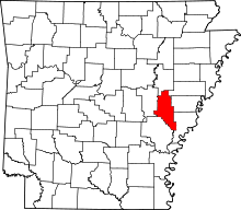 | |
| Towns | ||
| Unincorporated communities | ||
| Footnotes | ‡This populated place also has portions in an adjacent county or counties | |
This article is issued from
Wikipedia.
The text is licensed under Creative Commons - Attribution - Sharealike.
Additional terms may apply for the media files.