Kediet ej Jill
| Kediet ej Jill | |
|---|---|
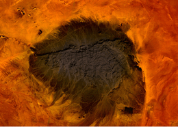 Mt. Kediet ej Jill, Mauritania - seen from space | |
| Highest point | |
| Elevation | 915 m (3,002 ft) |
| Prominence | 596 m (1,955 ft) |
| Listing | Country high point |
| Coordinates | 22°32′25″N 12°35′22″W / 22.54028°N 12.58944°WCoordinates: 22°32′25″N 12°35′22″W / 22.54028°N 12.58944°W |
| Geography | |
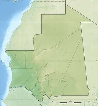 Kediet ej Jill Location of Kediet ej Jill in Mauritania | |
| Location | Mauritania |
Kediet ej Jill is a mountain in Tiris Zemmour, Mauritania, with the city of Zouérat on its east and Fderick at west. At 915 m (3,002 ft) tall, Kediet ej Jill is the highest peak in Mauritania.
The mountain and its surrounding area are rich in iron deposits, thought to have been mined since the 11th century, and commercially exploited since 1952. The current mines are connected to Nouadhibou on the Atlantic coast by a 700-km long railway.[1]
Due to the magnetic field, compasses cannot function on the mountain. Similar magnetic fields allowed the discovery of other deposits in the region (magnetite guelbs) in the 1960s.
References
- ↑ SNIM, Mauritania, www.mining-technology.com (access: January 25 2017)
External links
- Kediet ej Jill, Tiris Zemmour, Mauritania
- "Kdeyyat ej Joul, Mauritania". Peakbagger.com.
This article is issued from
Wikipedia.
The text is licensed under Creative Commons - Attribution - Sharealike.
Additional terms may apply for the media files.