Kauri, New Zealand
| Kauri | |
|---|---|
 Kauri | |
| Coordinates: 35°38′47″S 174°17′44″E / 35.64639°S 174.29556°ECoordinates: 35°38′47″S 174°17′44″E / 35.64639°S 174.29556°E | |
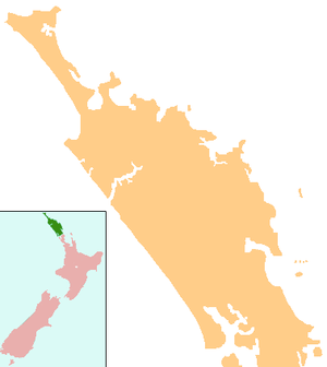
| Country | New Zealand |
| Region | Northland Region |
| District | Whangarei District |
Kauri is a locality in Northland, New Zealand. State Highway 1 passes through the area. Kamo is to the south, and Hikurangi is to the north.[1][2] Mt Parakiore is a volcanic dome rising 391 metres (1,283 ft) to the southwest. It is about one million years old, and part of the Harbour Fault, which also includes Mt Hikurangi near Hikurangi, and Parahaki in Whangarei.[3]
The area, initially called Kaurihohore, was settled by immigrants from Nova Scotia in 1856.[4][5]
Education
Kaurihohore School is a coeducational contributing primary school (years 1-6) school with a decile rating of 7[6] and a roll of 208[7] (August 2018). The school celebrated its 125th jubilee in 2002.[8]
Notes
- ↑ Peter Dowling (editor) (2004). Reed New Zealand Atlas. Reed Books. Map 5. ISBN 0-7900-0952-8.
- ↑ Roger Smith, GeographX (2005). The Geographic Atlas of New Zealand. Robbie Burton. Map 24. ISBN 1-877333-20-4.
- ↑ Bruce Hayward; Mike Isaac; Keith Miller; Bernhard Spörli (2002). "Introduction to Whangarei geology" (PDF). Geological Society of New Zealand. p. 27. Archived from the original (PDF) on 2009-03-04.
- ↑ Pickmere, Nancy Preece (1986). Whangarei: The Founding Years. pp. 76, 102.
- ↑ Centennial Committee, Kaurihohore (1957). The Story of Kaurihohore, 1856-1956.
- ↑ Te Kete Ipurangi schools database: Te Kete Ipurnphaka - Kaurihohore School
- ↑ "Directory of Schools - as at 13 September 2018". New Zealand Ministry of Education. Retrieved 22 September 2018.
- ↑ "Kaurihohore School 125th Jubilee". Education Gazette New Zealand. 81 (4). 11 March 2002.
This article is issued from
Wikipedia.
The text is licensed under Creative Commons - Attribution - Sharealike.
Additional terms may apply for the media files.