Katwoude
| Katwoude | |
|---|---|
| Town | |
 | |
 | |
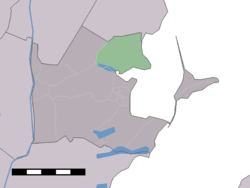 The statistical district of Katwoude in the municipality of Waterland. | |
| Coordinates: 52°28′N 5°3′E / 52.467°N 5.050°ECoordinates: 52°28′N 5°3′E / 52.467°N 5.050°E | |
| Country | Netherlands |
| Province |
|
| Municipality | Waterland |
| Time zone | UTC+1 (CET) |
| • Summer (DST) | UTC+2 (CEST) |
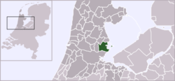
Katwoude is a town in the province of North Holland, Netherlands. It is a part of the municipality of Waterland, and lies on the coast of the IJsselmeer, about 2 km north of Monnickendam.
Katwoude was a separate municipality between 1817 and 1991, when it became part of Waterland.[1]
The statistical area "Katwoude", which covers the area of the former municipality, has a population of around 230.[2]
Gallery
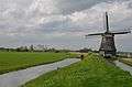 Polder windmill
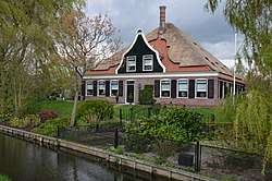
 Farm in Katwoude
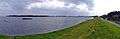 Monnickendam seen from Katwoude
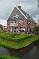 Jacobshoeve cheese factory
References
- ↑ Ad van der Meer and Onno Boonstra, Repertorium van Nederlandse gemeenten, KNAW, 2006.
- ↑ Statistics Netherlands (CBS), Gemeente Op Maat 2004: Waterland .
External links
- J. Kuyper, Gemeente Atlas van Nederland, 1865-1870, "Katwoude". Map of the former municipality, around 1868.
This article is issued from
Wikipedia.
The text is licensed under Creative Commons - Attribution - Sharealike.
Additional terms may apply for the media files.