Kasibugga
| Kasibugga | |
|---|---|
| town | |
 kt road | |
 Kasibugga Location in Andhra Pradesh, India | |
| Coordinates: 18°45′50″N 84°25′27″E / 18.764006°N 84.424130°ECoordinates: 18°45′50″N 84°25′27″E / 18.764006°N 84.424130°E | |
| Country | India |
| State | Andhra Pradesh |
| District | Srikakulam |
| Government | |
| • Type | Democratic |
| Area | |
| • Total | 42.75 km2 (16.51 sq mi) |
| Population | |
| • Total | 70,000 |
| • Density | 1,600/km2 (4,200/sq mi) |
| Languages | |
| • Official | Telugu |
| Time zone | UTC+5:30 (IST) |
| PIN | 532222 |
| Telephone code | 08945 |
| Vehicle registration | AP–30 |
| Website | Palasa–Kasibugga Municipality |
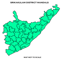
Kasibugga is a town of Palasa in Srikakulam district of the Indian state of Andhra Pradesh. It is a municipality and the part in mandal of Palasa .[1]
Geography
Kasibugga is located at 18° 45' 33N 84° 24' 58E. It has an average elevation of 38 meters (127 feet).[2]
Politics
Kasibugga is comes under Palasa (Assembly constituency) and the urban local body is ruled by Palasa-Kasibugga Municipality.[3]
Transport
Kasibugga is well connected with National Highway 16 and nearest railway station is Palasa railway station.[4]
References
- ↑ "Srikakulam district mandals" (PDF). Census of India. The Registrar General & Census Commissioner, India. pp. 175, 209. Retrieved 24 October 2017.
- ↑ "Maps, Weather, and Airports for Kasibugga, India".
- ↑ "politics of kasibugga" (PDF). india code. The Gazette of India. pp. 71, 209. Retrieved 18 May 2017.
- ↑ "Railway station". indianrailways. Retrieved 25 October 2017.
External links
This article is issued from
Wikipedia.
The text is licensed under Creative Commons - Attribution - Sharealike.
Additional terms may apply for the media files.