Karthalipalem
| Karthalipalem కర్తలిపాలెం | |
|---|---|
| Village | |
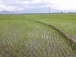 Karthalipalem paddy fields background with Mahendragiri hills | |
 Karthalipalem Location in Andhra Pradesh, India  Karthalipalem Karthalipalem (India) | |
| Coordinates: 18°53′25″N 84°31′39″E / 18.890212°N 84.527550°ECoordinates: 18°53′25″N 84°31′39″E / 18.890212°N 84.527550°E | |
| Country |
|
| State | Andhra Pradesh |
| District | Srikakulam |
| Government | |
| • Type | Gram Panchayat |
| Area[1] | |
| • Total | 6.03 km2 (2.33 sq mi) |
| Elevation[2] | 14 m (46 ft) |
| Population | |
| • Total | 2,853 |
| • Density | 470/km2 (1,200/sq mi) |
| Languages | |
| • Official | Telugu |
| Time zone | UTC+5:30 (IST) |
| PIN | 532264 |
| Vehicle registration | AP-30 |
Karthalipalem, also called Palem, is a village in Srikakulam district of the Indian state of Andhra Pradesh. It is located in Sompeta mandal and the River Mahendra tanaya flows besides the village.[3]
Demographics
The Karthalipalem village has population of 2853 of which 1414 are males while 1439 are females as per Population 2011, Indian Census.[4]
Government and politics
Karthalipalem Gram Panchayat is the Local self-government of the village The panchayat has a total of 11 wards and each ward is represented by an elected ward member The ward members are headed by a Sarpanch.[5]
References
- ↑ "Area of Village". village info. Retrieved 29 October 2017.
- ↑ "Elevation for Karthalipalem". Veloroutes. Retrieved 31 October 2017.
- ↑ "Details about Karthalipalem Village" (PDF). censusindia. Retrieved 20 March 2011.
- ↑ "Karthalipalem village information".
- ↑ "Government of Karthalipalem".
This article is issued from
Wikipedia.
The text is licensed under Creative Commons - Attribution - Sharealike.
Additional terms may apply for the media files.