Kapova Cave
| Капова пещера | |
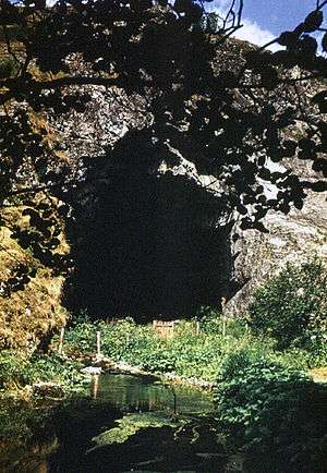 Kapova cave entrance | |
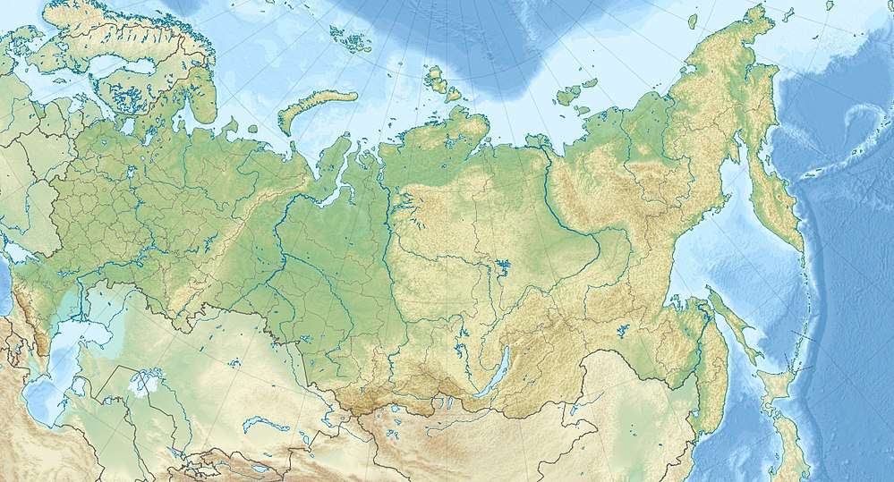 Location in Russia | |
| Location | Burzyansky District |
|---|---|
| Region | Bashkortostan, Russia |
| Coordinates | 53°2′39.9″N 57°3′50″E / 53.044417°N 57.06389°ECoordinates: 53°2′39.9″N 57°3′50″E / 53.044417°N 57.06389°E |
| Type | limestone cave |
| History | |
| Periods | Paleolithic |
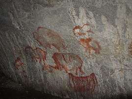
Kapova cave (Russian: Капова пещера, also known as Shul'gan-Tash, Bashkir: Шүлгәнташ) is a limestone karst cave in the Burzyansky District of Bashkortostan, Russia, ca. 200 km (120 mi) south-east of Ufa, in the southern Ural mountains. Located on the Belaya River in the natural reserve Shulgan-Tash, the cave is best known for the 16,000 years old Upper Paleolithic rock paintings and drawings.
The entrance to the cave is situated on the southern slope of the Sarykuskan (Russian: Сарыкускан) mountain. It forms a huge arch of 30 m (98 ft) height. To the left of the entrance to the cave is a lake from which the river Shul'gan (Russian: Шульган) originates. Inside the cave flows the underground Shul'gan (Russian: Подземный Шульган) river, that created the cave. This three-storey cave system is about 3 km (1.9 mi) long, with a vertical amplitude of 165 m (541 ft) including siphon underwater cavities, large halls, galleries, underground lakes and the river.
The Ignatievka Cave is located some 120 km (75 mi) from the Kapova cave.


References
Lawson, Andrew J. (2012). Painted Caves. Palaeolithic Rock Art in Western Europe. Oxford University Press. p. 197. ISBN 978-0-19-969822-6.
Silberman, Neil Asher, ed. (2012). The Oxford Companion to Archaeology. Oxford University Press. p. 176. ISBN 978-0-19-973578-5.