Kaohsiung International Airport MRT station
Kaohsiung International Airport 高雄國際機場 | |||||||||||
|---|---|---|---|---|---|---|---|---|---|---|---|
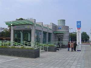 Kaohsiung International Airport station exit 1 | |||||||||||
| Location |
Siaogang, Kaohsiung Taiwan | ||||||||||
| Operated by | |||||||||||
| Line(s) |
| ||||||||||
| Platforms | One island platform | ||||||||||
| Construction | |||||||||||
| Structure type | Underground | ||||||||||
| History | |||||||||||
| Opened | 2008-03-09 | ||||||||||
| Traffic | |||||||||||
| Passengers | 3,070 daily (Jan. 2011)[1] | ||||||||||
| Services | |||||||||||
|
| |||||||||||
| Kaohsiung International Airport MRT station | |||||||||||
| Traditional Chinese | 高雄國際機場車站 | ||||||||||
|---|---|---|---|---|---|---|---|---|---|---|---|
| Simplified Chinese | 高雄国际机场车站 | ||||||||||
| |||||||||||
Kaohsiung International Airport is a station on the Red line of Kaohsiung MRT in Siaogang District, Kaohsiung, Taiwan.
Station overview
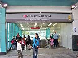
Kaohsiung International Airport station exit 6.
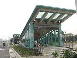
Kaohsiung International Airport station exit 7.
The station is a two-level, underground station with an island platform and seven exits.[2] It is 195 metres long and is located at the intersection of Jhongshan 4th Rd and Dayeh North Rd.[3]
This station was the first time a subway network had been linked to an airport in Taiwan. In Chinese, this station and Nangang Software Park station on the Taipei Metro share the longest subway station names in Taiwan.
Station layout
| Street Level | Entrance/Exit | Entrance/Exit |
| B1 | Concourse | Lobby, information desk, automatic ticket machines, one-way faregates |
| Restrooms (Near exits 2 & 4) | ||
| B2 | Platform 1 | ← KMRT Red Line toward Siaogang (Terminus) |
| Island platform, doors will open on the left | ||
| Platform 2 | → KMRT Red Line toward Gangshan South (Caoya) → | |
Exits
- Exit 1: Kaohsiung Park
- Exit 2: Under the skyway, near the Domestic Terminal
- Exit 3:
- Exit 4: Parking Lot, exit 3
- Exit 5: Parking Lot Pay Station (West)
- Exit 6: Outside the International Terminal
- Exit 7: Parking Lot, exit 2
Around the station
References
| Wikimedia Commons has media related to Kaohsiung International Airport Station. |
- ↑ "統計資訊 > 統計月報". Transportation Bureau, Kaohsiung City Government. Retrieved 2011-02-15.
- ↑ "高雄國際機場站". 高雄捷運公司. Retrieved 2010-07-10.
- ↑ "高雄國際機場車站週邊地圖". 高雄市政府捷運工程局. Archived from the original on 2010-09-15. Retrieved 2010-07-10.
Coordinates: 22°34′15″N 120°20′30″E / 22.57083°N 120.34167°E
This article is issued from
Wikipedia.
The text is licensed under Creative Commons - Attribution - Sharealike.
Additional terms may apply for the media files.