Houjing MRT station
Houjing 後勁 | |||||||||||
|---|---|---|---|---|---|---|---|---|---|---|---|
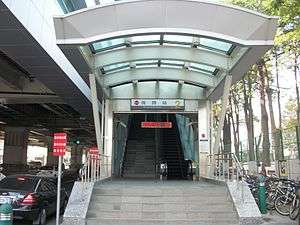 Houjing station exit 2 | |||||||||||
| Other names | National Kaohsiung Marine University; 海科大 | ||||||||||
| Location |
Nanzih, Kaohsiung Taiwan | ||||||||||
| Operated by | |||||||||||
| Line(s) |
| ||||||||||
| Platforms | Two Side platform | ||||||||||
| Construction | |||||||||||
| Structure type | Elevated | ||||||||||
| History | |||||||||||
| Opened | 2008-03-09 | ||||||||||
| Traffic | |||||||||||
| Passengers | 2,036 daily (Jan. 2011)[1] | ||||||||||
| Services | |||||||||||
|
| |||||||||||
| Houjing MRT station | |||||||||||
| Traditional Chinese | 後勁車站 | ||||||||||
|---|---|---|---|---|---|---|---|---|---|---|---|
| Simplified Chinese | 后劲车站 | ||||||||||
| |||||||||||
Houjing is a station on the Red line of Kaohsiung MRT in Nanzih District, Kaohsiung, Taiwan.
Station overview
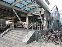
Sidewalk near exit 2 of Houjing station
The station is a three-level, elevated station with two Side platform and three exits.[2] It is 153 meters long and is located near the intersection of Jiachang Rd. and Haijhuan Rd.[3]
Station layout
| 3F | Side platform, Doors will open on the right | |
| Platform 1 | ← KMRT Red Line toward Siaogang (Nanzih Export Processing Zone) | |
| Platform 2 | → KMRT Red Line toward Gangshan South (Metropolitan Park) → | |
| Side platform, Doors will open on the right | ||
| 2F | Concourse | Lobby, information desk, automatic ticket machines, one-way faregates, Restrooms (Near Exits 4) |
| 1F | ||
| Street Level | Entrance/Exit | |
Exits
- Exit 1: Main gate of Houjing Junior High School
- Exit 2: National Kaohsiung Marine University
- Exit 3: Houjing Activity Center
- Accessibility Elevator located on both side of the station

Around the station
- Houjin River
- National University of Kaohsiung
- National Kaohsiung Marine University
- Houjing Junior High School
- Houjing Elementary School
References
| Wikimedia Commons has media related to Houjing Station. |
- ↑ "統計資訊 > 統計月報". Transportation Bureau, Kaohsiung City Government. Retrieved 2011-02-15.
- ↑ "後勁站". 高雄捷運公司. Archived from the original on 2010-12-17. Retrieved 2010-07-10.
- ↑ "後勁站週邊地圖". 高雄市政府捷運工程局. Archived from the original on 2007-12-04. Retrieved 2010-07-10.
Coordinates: 22°43′20″N 120°19′01″E / 22.72222°N 120.31694°E
This article is issued from
Wikipedia.
The text is licensed under Creative Commons - Attribution - Sharealike.
Additional terms may apply for the media files.