Kantalai Divisional Secretariat
| Kantalai කන්තලේ | |
|---|---|
| Divisional Secretariat | |
| Country |
|
| Province | Eastern Province |
| District | Trincomalee District |
| Population (2007) | |
| • Total | 42,861 |
| Time zone | UTC+5:30 (Sri Lanka Standard Time) |
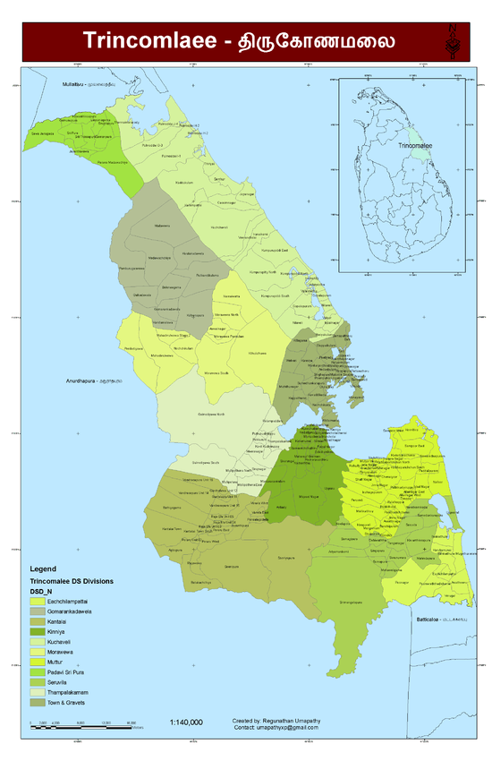
Kantalai is a Divisional Secretariat of Trincomalee District, in the Eastern Province of Sri Lanka. To the north it is bounded by Kinniya and Thambalagamuwa divisional secretariats, and to the east by Seruvila divisional secretariat. In the south it shares a boundary with Polonnaruwa District, while in the west it is bounded by Anuradhapura District, both of which are in the North Central Province.
In 2007 the division had a population of 42,861, of which 78.5 per cent were Sinhalese, 17.7 per cent Moors and 3.7 per cent Tamils. The population included 302 displaced persons, 95.0 per cent of whom had been forced to move by ethnic conflict, and 5.0 per cent by the 2004 Indian Ocean tsunami. The division is subdivided into 23 grama niladhari divisions.[1]
| Name | Population |
|---|---|
| Agbopura | 2,954 |
| Bathiyagama | 5,245 |
| Batuchchiya | 1,738 |
| Ganthalawa Unit 11 | 826 |
| Ganthalawa Unit 12 | 977 |
| Jayanthipura | 2,477 |
| Kanthale Town | 2,948 |
| Kanthalai Town South | 2,190 |
| Pansalgodella | 1,285 |
| Peraru East | 2,419 |
| Peraru Unit 02 | 1,477 |
| Peraru West | 3,193 |
| Rajaela Unit 03 | 922 |
| Rajaela Unit 04 | 1,412 |
| Rajaela Unit 05 | 1,026 |
| Rajawewa | 2,529 |
| Senipura | 568 |
| Sureyapura | 969 |
| Wanela East | 1,604 |
| Wanela West | 1,166 |
| Wenrasnpura Unit 14 | 1,879 |
| Wenrasapura Unit 15 | 1,417 |
| Wenrasapura Unit 16 | 1,640 |
References
- ↑ "Basic Population Information on Trincomalee District: Preliminary Report Based on Special Enumeration 2007" (PDF). Department of Census and Statistics. Retrieved 5 March 2012.
External links