Kamp
| Kamp | |
|---|---|
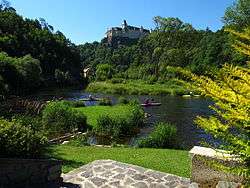 The Kamp near Rosenburg castle | |
| Country | Austria |
| Physical characteristics | |
| Main source | Waldviertel |
| River mouth |
Danube 48°23′N 15°48′E / 48.383°N 15.800°ECoordinates: 48°23′N 15°48′E / 48.383°N 15.800°E |
| Length | 168.4 km (104.6 mi) [1] |
| Basin features | |
| Progression | Danube→ Black Sea |
The Kamp is a 168 km long river in northern Austria, left tributary of the Danube. The source of the Kamp is on the border of Lower Austria and Upper Austria, near the town Liebenau, in the Mühlviertel. It flows generally east through Rappottenstein (where it receives its tributary Kleine Kamp), Zwettl, Krumau am Kamp and Gars am Kamp. The Kamp flows into the Danube near Grafenwörth, east of Krems.
References
- ↑ Niederösterreich Atlas (Lower Austria)
External links

This article is issued from
Wikipedia.
The text is licensed under Creative Commons - Attribution - Sharealike.
Additional terms may apply for the media files.