Rappottenstein
| Rappottenstein | ||
|---|---|---|
| ||
 Rappottenstein Location within Austria | ||
| Coordinates: 48°31′00″N 15°04′00″E / 48.51667°N 15.06667°ECoordinates: 48°31′00″N 15°04′00″E / 48.51667°N 15.06667°E | ||
| Country | Austria | |
| State | Lower Austria | |
| District | Zwettl | |
| Government | ||
| • Mayor | Friedrich Wagner (ÖVP) | |
| Area | ||
| • Total | 65.76 km2 (25.39 sq mi) | |
| Elevation | 671 m (2,201 ft) | |
| Population (1 January 2016)[1] | ||
| • Total | 1,729 | |
| • Density | 26/km2 (68/sq mi) | |
| Time zone | UTC+1 (CET) | |
| • Summer (DST) | UTC+2 (CEST) | |
| Postal code | 3911 | |
| Area code | 02828 | |
| Vehicle registration | ZT | |
| Website | www.rappottenstein.at | |

Rappottenstein is a municipality in the district of Zwettl in the Austrian state of Lower Austria.
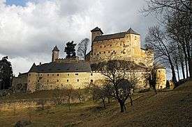
Rappottenstein castle
Neighboring municipalities
Places adjacent to Rappottenstein | |
|---|---|

Gallery
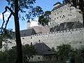 Rappottestein Castle
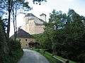 Rappottenstein Castle
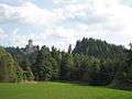 Rappottenstein Castle
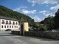 View in Rappottenstein
 Rappottenstein Shrine by roadside
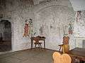 Rappotenstein Painted room in Castle
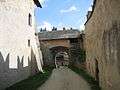 Rappotenstein Castle Lower gateway
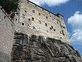 Rappotenstein Castle
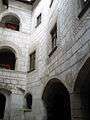 Rappottenstein Castle Courtyard
References
This article is issued from
Wikipedia.
The text is licensed under Creative Commons - Attribution - Sharealike.
Additional terms may apply for the media files.