Kamp-Lintfort
| Kamp-Lintfort | |||
|---|---|---|---|
 Terraced gardens of Kamp Abbey | |||
| |||
 Kamp-Lintfort Location of Kamp-Lintfort within Wesel district 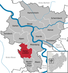  | |||
| Coordinates: 51°30′00″N 06°32′0″E / 51.50000°N 6.53333°ECoordinates: 51°30′00″N 06°32′0″E / 51.50000°N 6.53333°E | |||
| Country | Germany | ||
| State | North Rhine-Westphalia | ||
| Admin. region | Düsseldorf | ||
| District | Wesel | ||
| Government | |||
| • Mayor | Christoph Landscheidt (SPD) | ||
| Area | |||
| • Total | 63.16 km2 (24.39 sq mi) | ||
| Elevation | 33 m (108 ft) | ||
| Population (2016-12-31)[1] | |||
| • Total | 37,414 | ||
| • Density | 590/km2 (1,500/sq mi) | ||
| Time zone | CET/CEST (UTC+1/+2) | ||
| Postal codes | 47475 | ||
| Dialling codes | 0 28 42 | ||
| Vehicle registration | WES | ||
| Website |
www | ||


Kamp-Lintfort is a town in Wesel District, in North Rhine-Westphalia, Germany. It is located 8 kilometres (5 miles) north-west of Moers.
Sons and daughters of the town
- Adolf Storms (1919-2010), member of the Waffen-SS and war criminal
- Werner Fuchs (1927-2005), painter
- Brigitte Asdonk (born 1947), founding member of the Red Army Faction
International relations
Twin towns — sister cities
Kamp-Linfort is twinned with:


Climate
Köppen-Geiger climate classification system classifies its climate as oceanic (Cfb).[3] It lies within the Rhine-Ruhr area which is characterized by having the warmest winters in Germany.
| Climate data for Kamp-Lintfort | |||||||||||||
|---|---|---|---|---|---|---|---|---|---|---|---|---|---|
| Month | Jan | Feb | Mar | Apr | May | Jun | Jul | Aug | Sep | Oct | Nov | Dec | Year |
| Average high °C (°F) | 4.3 (39.7) |
5.4 (41.7) |
9.6 (49.3) |
14 (57) |
18.5 (65.3) |
21.5 (70.7) |
22.9 (73.2) |
22.7 (72.9) |
19.7 (67.5) |
14.6 (58.3) |
8.8 (47.8) |
5.5 (41.9) |
14 (57.1) |
| Daily mean °C (°F) | 1.9 (35.4) |
2.5 (36.5) |
6.2 (43.2) |
9.3 (48.7) |
13.3 (55.9) |
16.3 (61.3) |
17.9 (64.2) |
17.8 (64) |
15.1 (59.2) |
10.7 (51.3) |
6.1 (43) |
3.2 (37.8) |
10 (50) |
| Average low °C (°F) | −0.5 (31.1) |
−0.3 (31.5) |
2.8 (37) |
4.6 (40.3) |
8.2 (46.8) |
11.2 (52.2) |
13 (55) |
12.9 (55.2) |
10.5 (50.9) |
6.9 (44.4) |
3.5 (38.3) |
0.9 (33.6) |
6.1 (43) |
| Average precipitation mm (inches) | 67 (2.64) |
48 (1.89) |
63 (2.48) |
52 (2.05) |
68 (2.68) |
81 (3.19) |
76 (2.99) |
69 (2.72) |
63 (2.48) |
63 (2.48) |
65 (2.56) |
75 (2.95) |
790 (31.11) |
| Source: Climate-Data.org (altitude: 29m)[3] | |||||||||||||
References
- ↑ "Amtliche Bevölkerungszahlen" (in German). Landesbetrieb Information und Technik NRW. Retrieved 2018-02-24.
- ↑ Sister/Twin Cities of Balıkesir Province
- 1 2 "Temperature, Climate graph, Climate table for Kamp-Lintfort". Climate-Data.org. Retrieved 2017-09-25.
Towns and municipalities in Wesel (district) | ||
|---|---|---|
| Authority control |
|---|
This article is issued from
Wikipedia.
The text is licensed under Creative Commons - Attribution - Sharealike.
Additional terms may apply for the media files.