Kamarhati, Nadia
| Kamarhati | |
|---|---|
| Village | |
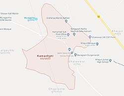 Map of Kamarhati taken from Google maps | |
 Kamarhati Location in West Bengal, India | |
| Coordinates: 23°31′22″N 88°25′39″E / 23.522852°N 88.427493°ECoordinates: 23°31′22″N 88°25′39″E / 23.522852°N 88.427493°E | |
| Country |
|
| State | West Bengal |
| District | Nadia |
| Population | |
| • Total | 2,231[1] |
| Languages | |
| • Official | Bengali, English |
| Time zone | UTC+5:30 (IST) |
| PIN | 741154 |
| Telephone code | 91 3472 |
| Gram Panchayet | Sadhanpara 1 No. Gram Panchayet |
Kamarhati is a village[2] in Krishnanagar II CD Block in Krishnanagar Sadar subdivision of Nadia district of West Bengal, India beside Dhubulia. Most of the people in this village are Hindu in religion. There are three villages surrounded Kamarhati, named Muragachha, Banagram, Chupipota, Ghateswar, where Banagram is a small locality at the interface of Kamarhati and Ghateswar. Krishnanagar is the nearest town from Kamarhati.
History
Many people migrated to Kamarhati from Bangladesh at the time of the partition of India in 1947.
Geography
Kamarhati is located at 23°31′22″N 88°25′39″E / 23.522852°N 88.427493°E. Most of the land is used for cultivation. Farmers from here grow crops like rice, mustard, jute and vegetables.
Police station
Police station of Kamarhati is Dhubulia Police Station which has jurisdiction over Krishnanagar II CD Block.[3]The total area covered by the police station is 134.74 km2.
Post Office
In this village, a branch post office is situated named Kamarhati Branch Post Office and postal code is 741154.[4]
Economy
Most of the people of Kamarhati depends on Cultivation. Also, many of them earn from Cottage industry.
Education
For giving education among children and new generation many school are here.
References
- ↑ "Census 2011".
- ↑ "District Census Handbook: Nadia, Series 20 Part XII A" (PDF). List of villages of Krishnagar-II CD Block (on the 321 page and sl. no. 23). Directorate of Census Operations, West Bengal, 2011. Retrieved 2 May 2017.
- ↑ "Nadia District Police". Police Unit. West Bengal Police. Retrieved 17 May 2017.
- ↑ "Kamarhati Branch Post Office".
- ↑ "Kamarhati Chittaranjan High School".
- ↑ "Banagram Board Primary School".
- ↑ "Kamarhati Shyamlalgsfp School".