Kaliro
| Kaliro Kaliro town council | |
|---|---|
 Kaliro Location in Uganda | |
| Coordinates: 00°53′42″N 33°30′18″E / 0.89500°N 33.50500°E | |
| Country |
|
| Region | Eastern Uganda |
| Sub-region | Busoga sub-region |
| District | Kaliro District |
| Government | |
| • Mayor | Sam Gamutambuli |
| Elevation | 3,540 ft (1,080 m) |
| Population (2014 Census) | |
| • Total | 16,796[1] |
Kaliro is a town in the Eastern Region of Uganda. It is the main municipal, administrative, and commercial center of Kaliro District and the site of the district headquarters.
Location
Kaliro is approximately 40 kilometres (25 mi) north of Iganga, the nearest large town, on an all-weather tarmacked road.[2] This is approximately 153 kilometres (95 mi), by road, northeast of Kampala, Uganda's capital and largest city.[3] The coordinates of the town are 0°53'42.0"N, 33°30'18.0"E (Latitude:0.8950; Longitude:33.5050).[4]
Population
In 2002, the national population census estimated the town's population at 39,900. In 2010, the Uganda Bureau of Statistics (UBOS) estimated the population at 13,300. In 2011, UBOS estimated the population at 13,700.[5] In 2014, the national census put the population at 16,796.[1]
Administration
Kaliro is led by an elected mayor and elected town council. As of 2017, the mayor is Sam Gamutambuli.[6]
Points of interest
The following points of interest lie within the town or close to its borders:
- Zibondo’s palace - The palace of Ezekieri Tenywa Wako Zibondo IX, Isebantu (King) of Busoga from 15 March 1893 until 18 April 1952, is located less than 2 kilometres (1.2 mi) east of the central business district of Kaliro. The palace was built in 1930.
- Buguge historical site - The site is located about 15 kilometres (9.3 mi) north of Kaliro in Saaka Parish, Namwiwa sub-county. The site is believed to have been the settlement of the first Lamogi (Chief) from the Babiito rulers of the Biito Dynasty of Bunyoro. At the site are two graves, located 100 metres (330 ft) apart, said to be of the first Lamogi (Chief) and his escort (Mukama) from the Biito Dynasty of Bunyoro
- offices of Kaliro Town Council
- Kaliro central market
- National Teachers' College Kaliro, one of five government teacher training institutions for secondary school teachers.
See also
References
- 1 2 "UBOS, . (29 November 2014). "The Population of The Regions of the Republic of Uganda And All Cities And Towns of More Than 15,000 Inhabitants". Citypopulation.de Quoting Uganda Bureau of Statistics (UBOS). Retrieved 28 February 2015.
- ↑ "Map Showing Iganga And Kaliro With Distance Marker". Globefeed.com. Retrieved 31 May 2014.
- ↑ "Road Distance Between Kampala And Kaliro With Map". Globefeed.com. Retrieved 31 May 2014.
- ↑ Google (12 July 2015). "Location of Kaliro At Google Maps" (Map). Google Maps. Google. Retrieved 12 July 2015.
- ↑ UBOS, . "Estimated Population of Kaliro In 2002, 2010 & 2011" (PDF). Uganda Bureau of Statistics (UBOS). Archived from the original (PDF) on 7 July 2014. Retrieved 31 May 2014.
- ↑ Gwebayanga, Tom (8 January 2012). "Kaliro Mayor, Speaker Survive Lynching". New Vision. Retrieved 31 May 2014.
External links
Capital: Kaliro | ||
| Towns and villages | 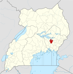 | |
| Economy | ||
| Banking | ||
| Transport | ||
| Notable landmarks |
| |
| Notable people | ||