Kajara Ramaul
| Kajara Ramaul कजरा रमौल | |
|---|---|
| Village development committee | |
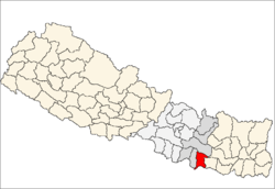
 Kajara Ramaul Location in Nepal | |
| Coordinates: 26°29′N 86°30′E / 26.48°N 86.50°ECoordinates: 26°29′N 86°30′E / 26.48°N 86.50°E | |
| Country |
|
| Zone | Janakpur Zone |
| District | Dhanusa District |
| Population (2011) | |
| • Total | 5,218 |
| • Density | 0.5/km2 (1/sq mi) |
| Time zone | UTC+5:45 (Nepal Time) |
Kajara Ramaul is a village development committee in Dhanusa District in the Janakpur Zone of south-eastern Nepal. At the time of the 2011 Nepal census it had a population of 5,218 persons living in 953 individual households.[1]
References
- ↑ "Nepal Census 2011" (PDF). Archived from the original (PDF) on 10 June 2014. Retrieved 16 October 2015.
External links
This article is issued from
Wikipedia.
The text is licensed under Creative Commons - Attribution - Sharealike.
Additional terms may apply for the media files.