Kagamba
| Kagamba | |
|---|---|
 Kagamba Location in Uganda | |
| Coordinates: 00°49′05″S 30°09′36″E / 0.81806°S 30.16000°E | |
| Country |
|
| Region | Western Region of Uganda |
| Sub-region | Ankole sub-region |
| District | Ntungamo District |
| Elevation | 3,220 ft (980 m) |
Kagamba is a town in the Ntungamo District of the Western Region of Uganda.
Location
Kagamba is located approximately 15 kilometres (9 mi) west of Ntungamo, on the Ntungamo-Rukungiri road.[1] The coordinates of the town are 0°49'05.0"S, 30°09'36.0"E (Latitude:-0.8181; Longitude:30.1600).[2]
Points of interest
The following points of interest lie within Kagamba or near its borders:
- Kagamba Roman Catholic Parish Church, affiliated with the Roman Catholic Archdiocese of Mbarara
- southern end of the 36.5 kilometres (23 mi) Ishaka–Kagamba Road.[3]
- Ntungamo–Rukungiri Road, passing through the town in a general southeast to northwest direction.
See also
References
- ↑ GFC (14 July 2015). "Road Distance Between Ntungamo And Kagamba With Map". Globefeed.com (GFC). Retrieved 14 July 2015.
- ↑ Google (14 July 2015). "Location of Kagamba At Google Maps" (Map). Google Maps. Google. Retrieved 14 July 2015.
- ↑ GFC, . (14 July 2015). "Approximate Road Distance Between Kagamba And Ishaka With Map". Globefeed.com (GFC). Retrieved 14 July 2015.
External links
Capital: Ntungamo | ||
| Towns and villages | 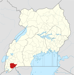 | |
| Economy | ||
| Health | ||
| Transport | ||
| Notable people | ||
This article is issued from
Wikipedia.
The text is licensed under Creative Commons - Attribution - Sharealike.
Additional terms may apply for the media files.