Joyland, North Carolina
| Joyland, North Carolina | |
|---|---|
| Unincorporated community | |
 Joyland Location within the state of North Carolina | |
| Coordinates: 35°59′29″N 78°51′16″W / 35.99139°N 78.85444°WCoordinates: 35°59′29″N 78°51′16″W / 35.99139°N 78.85444°W | |
| Country | United States |
| State | North Carolina |
| County | Durham |
| Time zone | UTC-5 (Eastern (EST)) |
| • Summer (DST) | UTC-4 (EDT) |
| GNIS feature ID | 1020993 |
Joyland is an unincorporated community in Durham County, North Carolina, United States, on North Carolina Highway 98, east of its junction with U.S. Route 70. It has been annexed by Durham.
External links
- Joyland at the U.S. Geographic Names Information System
Municipalities and communities of Durham County, North Carolina, United States | ||
|---|---|---|
| Cities | 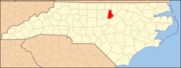 | |
| Towns | ||
| Townships | ||
| CDPs | ||
| Unincorporated communities | ||
| Footnotes | ‡This populated place also has portions in an adjacent county or counties | |
This article is issued from
Wikipedia.
The text is licensed under Creative Commons - Attribution - Sharealike.
Additional terms may apply for the media files.