Jordan Township, Lycoming County, Pennsylvania
| Jordan Township, Lycoming County, Pennsylvania | |
|---|---|
| Township | |
 A field in Jordan Township | |
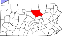
 Map of Lycoming County, Pennsylvania highlighting Jordan Township | |
 Map of Lycoming County, Pennsylvania | |
| Coordinates: 41°14′12″N 76°31′5″W / 41.23667°N 76.51806°WCoordinates: 41°14′12″N 76°31′5″W / 41.23667°N 76.51806°W | |
| Country | United States |
| State | Pennsylvania |
| County | Lycoming |
| Settled | 1812 |
| Incorporated | 1854 |
| Area[1] | |
| • Total | 20.93 sq mi (54.20 km2) |
| • Land | 20.89 sq mi (54.11 km2) |
| • Water | 0.03 sq mi (0.09 km2) |
| Elevation[2] | 1,263 ft (385 m) |
| Population (2010) | |
| • Total | 863 |
| • Estimate (2016)[3] | 858 |
| • Density | 41.07/sq mi (15.86/km2) |
| Time zone | UTC-5 (Eastern (EST)) |
| • Summer (DST) | UTC-4 (EDT) |
| FIPS code | 42-081-38448 |
| GNIS feature ID | 1216752[2] |
Jordan Township is a township in Lycoming County, Pennsylvania, United States. The population was 878 at the 2000 census. It is part of the Williamsport, Pennsylvania Metropolitan Statistical Area.
History
Jordan Township was formed from the eastern part of Franklin Township on February 7, 1854. It was named in honor of Alexander Jordan who was president judge of the district court at the time of the formation of the township. The first permanent settler arrived in Jordan Township in 1812. William Lore cleared a parcel of land and established a homestead, others soon followed his footsteps. The lumber industry was very important in Jordan Township for the first 70 years of its history. The hills and valleys were cleared of their old-growth forests by the end of the 19th century.[4] Today much of those forests forming a thriving second growth forest.
Geography
Jordan Township is bordered by Sullivan County to the northeast, Columbia County to the southeast, and Franklin Township to the west. Jordan Township lies in the easternmost portion of southern Lycoming County.[5] As the crow flies, Lycoming County is about 130 miles (209 km) northwest of Philadelphia and 165 miles (266 km) east-northeast of Pittsburgh.
According to the United States Census Bureau, the township has a total area of 20.7 square miles (54 km2), all of it land.
Demographics
| Historical population | |||
|---|---|---|---|
| Census | Pop. | %± | |
| 2010 | 863 | — | |
| Est. 2016 | 858 | [3] | −0.6% |
| U.S. Decennial Census[6] | |||
As of the census[7] of 2000, there were 878 people, 346 households, and 252 families residing in the township. The population density was 42.4 people per square mile (16.4/km2). There were 407 housing units at an average density of 19.7/sq mi (7.6/km2). The racial makeup of the township was 99.66% White and 0.34% African American.
There were 346 households, out of which 30.3% had children under the age of 18 living with them, 59.8% were married couples living together, 6.9% had a female householder with no husband present, and 26.9% were non-families. 23.4% of all households were made up of individuals, and 13.3% had someone living alone who was 65 years of age or older. The average household size was 2.54 and the average family size was 2.99.
In the township the population was spread out, with 24.4% under the age of 18, 6.6% from 18 to 24, 27.6% from 25 to 44, 25.1% from 45 to 64, and 16.4% who were 65 years of age or older. The median age was 39 years. For every 100 females there were 102.3 males. For every 100 females age 18 and over, there were 97.0 males.
The median income for a household in the township was $32,375, and the median income for a family was $37,589. Males had a median income of $28,250 versus $20,515 for females. The per capita income for the township was $16,983. About 8.3% of families and 13.1% of the population were below the poverty line, including 14.1% of those under age 18 and 24.2% of those age 65 or over.
References
- ↑ "2016 U.S. Gazetteer Files". United States Census Bureau. Retrieved Aug 14, 2017.
- 1 2 "US Board on Geographic Names". United States Geological Survey. 2007-10-25. Retrieved 2008-01-31.
- 1 2 "Population and Housing Unit Estimates". Retrieved June 9, 2017.
- ↑ Meginness, John Franklin (1892). "Muncy Creek, Moreland, Franklin, and Jordan". History of Lycoming County, Pennsylvania: including its aboriginal history; the colonial and revolutionary periods; early settlement and subsequent growth; organization and civil administration; the legal and medical professions; internal improvement; past and present history of Williamsport; manufacturing and lumber interests; religious, educational, and social development; geology and agriculture; military record; sketches of boroughs, townships, and villages; portraits and biographies of pioneers and representative citizens, etc. etc (1st ed.). Chicago: Brown, Runk & Co. ISBN 0-7884-0428-8. Retrieved 2007-02-20.
(Note: ISBN refers to Heritage Books July 1996 reprint. URL is to a scan of the 1892 version with some OCR typos).
- ↑ "2007 General Highway Map Lycoming County Pennsylvania" (PDF) (Map). 1:65,000. Pennsylvania Department of Transportation, Bureau of Planning and Research, Geographic Information Division. Retrieved 2009-12-24.
- ↑ "Census of Population and Housing". Census.gov. Retrieved June 4, 2016.
- ↑ "American FactFinder". United States Census Bureau. Retrieved 2008-01-31.
| Wikimedia Commons has media related to Jordan Township, Lycoming County, Pennsylvania. |
Municipalities and communities of Lycoming County, Pennsylvania, United States | ||
|---|---|---|
| City | | |
| Boroughs | ||
| Townships |
| |
| CDPs | ||
| Unincorporated communities | ||
| Ghost town | ||
| Footnotes | ‡This populated place also has portions in an adjacent county | |