Jičín Airport
| Jičín Airport Letiště Jičín | |||||||||||
|---|---|---|---|---|---|---|---|---|---|---|---|
 | |||||||||||
| Summary | |||||||||||
| Airport type | Public | ||||||||||
| Operator | Aeroklub Jičín o.s. | ||||||||||
| Serves | Jičín | ||||||||||
| Location | 1.8 kilometres (1.1 mi) SW from Jičína | ||||||||||
| Elevation AMSL | 863 ft / 263 m | ||||||||||
| Coordinates | 50°25′48″N 015°19′59″E / 50.43000°N 15.33306°ECoordinates: 50°25′48″N 015°19′59″E / 50.43000°N 15.33306°E | ||||||||||
| Website | www.jicin-airport.cz | ||||||||||
| Runways | |||||||||||
| |||||||||||
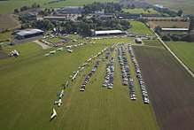
Jičín Airport (Czech: Letiště Jičín) (ICAO: LKJC[1][2]) is a public aerodrome with civil traffic. It is situated approximately 1.8 kilometres (1 mi) southwest of Jičín, a town in the Hradec Králové Region of the Czech Republic, at the border of Bohemian Paradise. The airport is plentifully used for sport flying and sightseeing flights above Prachov Rocks eventually the Giant Mountains.
Local Traffic Regulations and Restrictions
The airport is designed for use by VFR flights in the day time and parachute jumping operation. Operational hours are 8:00-15:00 UTC in SAT, SUN, HOL from 15 April to 15 October. Outside operational hours arrivals are permitted only by prior arrangement with airfield operator (check on a serviceability of movement areas). Arrivals of aircraft without two-way radio communication are possible only by previous agreement with airfield operator.
Operation data
Traffic circuits: RWY 12 right hand / RWY 30 left hand
Traffic circuits altitude: 1900 ft/580m AMSL
Frequency: 118,080 MHz (Jičín INFO)
References
- ↑ Airport information for LKJC at Great Circle Mapper.
- ↑ Accident history for LKJC at Aviation Safety Network