Jebel Al Mebrah
| Jebel Al Mebrah | |
|---|---|
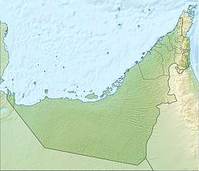 Jebel Al Mebrah Location of Jebel Al Mebrah in the United Arab Emirates | |
| Highest point | |
| Elevation | 1,727 m (5,666 ft) |
| Coordinates | 25°38′54″N 56°07′45″E / 25.64833°N 56.12917°ECoordinates: 25°38′54″N 56°07′45″E / 25.64833°N 56.12917°E |
| Geography | |
| Location | Ras Al Khaimah United Arab Emirates |
Jebel Al Mebrah (Arabic: جبل المبرح) is a 1727 m (5666 ft)[1] tall mountain in the United Arab Emirates (UAE). It is located in the Hajar Mountains near 25°38′54″N 56°7′45″E / 25.64833°N 56.12917°E. Jebel Al Mebrah has a prominence of around 300 m from its parent peak, Jebel Qihwi, which is on the other side of the border in Musandam, Oman. The highest point in the UAE is Jebel Jais (Ras Al Khaimah) at about 1910 m just across the border from Jebel Jais, also in Musandam, meaning that Jebel Al Mebrah is not the highest point but the highest peak in the UAE.
A military station is located on the summit making the peak out of access, however, an asphalt road has been built up from wadi Tawian, with many villages along the sides and tracks continuing further into the mountains. Initially this allowed public access to within 400 m of the military station, around 100 m (328 feet) below. Since 2016 however a military check point at the bottom of the mountain has prevented access to the public by road altogether.
References
- ↑ "Geography of United Arab Emirates, Landforms - World Atlas". www.worldatlas.com. Retrieved 2017-03-27.