Jamanxim River
| Jamanxim River | |
|---|---|
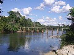 Bridge over the Jamaxim | |
 Mouth location in Brazil | |
| Native name | Rio Jamanxim |
| Country | Brazil |
| Physical characteristics | |
| Main source |
Pará 460 metres (1,510 ft) |
| River mouth |
40 metres (130 ft) 4°45′23″S 56°26′15″W / 4.756260°S 56.437500°WCoordinates: 4°45′23″S 56°26′15″W / 4.756260°S 56.437500°W |
| Length | 510 kilometres (320 mi)[1] |
| Basin features | |
| River system | Tapajós |
The Jamanxim River is a river of Pará state in north-central Brazil. Originating in the Serra do Cachimbo, it is a tributary of the Tapajós, into which it flows a few kilometers upstream from Itaituba.
Course
The river flows through the Tapajós-Xingu moist forests ecoregion.[[Sears {{{last}}}|Sears {{{last}}}]] It flows through the Itaituba I National Forest, a 220,639 hectares (545,210 acres) sustainable use conservation area established in 1998.[2] The river basin also contains part of the 538,151 hectares (1,329,800 acres) Rio Novo National Park, a conservation unit created in 2006.[3]
Hydroelectric potential
Its hydroelectric potential, along with that of the Tapajós, was assessed by Eletronorte (Centrais Elétricas do Norte do Brasil S.A.), the regional power authority, identfying nine potential dam sites, including four along the Jamanxim. at Cachoeira dos Patos, (estimated at 28 MW); Cachoeira do Caí, (estimated at 802 MW); at Jardim do Ouro and at Jamanxim (estimated at 881 MW). If all were constructed, these dams would flood a total of 103,700 ha, including 33,216 ha of the Jamanxim National Park and 25,849 ha of the Jamanxim, Itaituba I, Itaituba II and Altamira national forests.[4]
See also
References
Sources
- Sears, Robin, Amazon Basin - Brazil (NT0168), WWF: World Wildlife Fund, retrieved 2017-03-20
- Unidade de Conservação: Floresta Nacional de Itaituba I (in Portuguese), MMA: Ministério do Meio Ambiente, retrieved 2016-05-29
- Unidade de Conservação: Parque Nacional do Rio Novo (in Portuguese), MMA: Ministério do Meio Ambiente, retrieved 2016-05-27
- Ziesler, R.; Ardizzone, G.D. (1979), "Amazon River System", The Inland waters of Latin America, Food and Agriculture Organization of the United Nations, ISBN 92-5-000780-9, archived from the original on 8 November 2014