Jajinci
| Jajinci Јајинци | |
|---|---|
| Urban neighbourhood | |
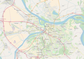 Jajinci Location within Belgrade | |
| Coordinates: 44°44′N 20°29′E / 44.733°N 20.483°ECoordinates: 44°44′N 20°29′E / 44.733°N 20.483°E | |
| Country |
|
| Region | Belgrade |
| Municipality | Voždovac |
| Area | |
| • Total | 5.13 km2 (1.98 sq mi) |
| Time zone | UTC+1 (CET) |
| • Summer (DST) | UTC+2 (CEST) |
| Area code | +381(0)11 |
| Car plates | BG |
Jajinci (Serbian: Јајинци), pronounced [jâjiːntsi]) is an urban neighborhood located in the municipality of Voždovac, in Belgrade, the capital of Serbia. It was the site of the worst carnage in Serbia during World War II when German occupational forces executed nearly 80,000 people, many of them prisoners of the nearby Banjica concentration camp. Jewish women and children from German Sajmište concentration camp, killed in a special gas truck on their way to Belgrade were also buried here.
Location
Jajinci is located in the Lipnica creek valley. Once a small village far from downtown Belgrade, Jajinci today has grown into one continuous metropolitan area with the rest of the city. It borders the neighborhoods of Banjica on the north, Kumodraž on the east and Selo Rakovica on the south. The eastern border of the neighborhood is marked by the Jelezovac creek, which also forms a border with the municipality of Rakovica.
Characteristics
The settlement spreads from the central street, the Boulevard of Liebration, which starts in central Belgrade (the Slavija square). A former village and separate settlement, Jajinci is today a local community (mesna zajednica) within the municipality of Voždovac. Unlike neighboring Banjica, it was never developed with high modern buildings and remained a settlement of smaller, family houses, but did evolve from agricultural into a typical suburban area with most inhabitants working in Belgrade.
A large rasadnik (nursery garden) is located in the north of the neighborhood, and the "Jajinci" memorial park is in the southern section.
Mala Utrina
A western sub-settlement of Jajinci located along the lower course of the Lipovica creek, near where it flows into the Jelezovac. It is a direct extension of the rasadnik in the north.
It is situated 500 m (1,600 ft) from the Banjica direction. As of 2018, it still lacked proper communal infrastructure.[1]
Maxima
A southern sub-settlement of Jajinci. Because of luxury houses, mansions and villas, people call this part of Jajinci New Dedinje.
Population
| Historical population | ||
|---|---|---|
| Year | Pop. | ±% |
| 1910 | 458 | — |
| 1921 | 489 | +6.8% |
| 1931 | 922 | +88.5% |
| 1948 | 875 | −5.1% |
| 1953 | 1,080 | +23.4% |
| 1961 | 2,572 | +138.1% |
| 1971 | 3,879 | +50.8% |
| 1981 | 4,386 | +13.1% |
| 1991 | 4,396 | +0.2% |
| 2002 | 6,986 | +58.9% |
| 2011 | 8,876 | +27.1% |
| Source: [2][3][4][5][6][7][8][9][10][11][12] | ||
Jajinci was a separate settlement until 1972 when it was officially annexed into the Belgrade City Proper (uža teritorija grada). In the 20th century it experienced constant population growth until the 1990s. The Yugoslav Wars brought a large influx of refugees, and Jajinci continued to grow in the early 2000s.
World War II
A former military shooting ground near Jajinci was used by the Nazis as an execution place for almost 80,000 people in the period between 1941–44, most of them Serbs and Jews. Many of them were prisoners, either Communists or public figures opposing the German occupation, from the Banjica concentration camp. A large memorial park, with a monument to the victims, was opened on October 20, 1964, marking the 20th anniversary of the Partisan army entering Belgrade.
References
- ↑ Zdravko Zdravković (8 March 2018). "Kanalizacija kao Potemkinova sela" [Sewage like Potemkin village]. Politika (in Serbian).
- ↑ Претходни резултати пописа становништва и домаће стоке у Краљевини Србији 31 декембра 1910 године, Књига V, стр. 12 [Preliminary results of the census of population and husbandry in Kingdom of Serbia on 31 December 1910, Vol. V, page 12]. Управа државне статистике, Београд (Administration of the state statistics, Belgrade). 1911.
- ↑ Final results of the census of population from 31 January 1921. Kingdom of Yugoslavia - General State Statistics, Sarajevo. June 1932.
- ↑ Final results of the census of population from 31 March 1931. Kingdom of Yugoslavia - General State Statistics, Belgrade. 1937.
- ↑ Final results of the population census of March 15th 1948, Volume IX, Population by ethnic nationality. Federal Statistical, Belgrade. 1954.
- ↑ Popis stanovništva 1953, Stanovništvo po narodnosti (pdf). Savezni zavod za statistiku, Beograd.
- ↑ Popis stanovništva 1961, Stanovništvo prema nacionalnom sastavu (pdf). Savezni zavod za statistiku, Beograd.
- ↑ Popis stanovništva 1971, Stanovništvo prema nacionalnom sastavu (pdf). Savezni zavod za statistiku, Beograd.
- ↑ Osnovni skupovi stanovništva u zemlji – SFRJ, SR i SAP, opštine i mesne zajednice 31.03.1981, tabela 191. Savezni zavod za statistiku (txt file). 1983.
- ↑ Stanovništvo prema migracionim obeležjima – SFRJ, SR i SAP, opštine i mesne zajednice 31.03.1991, tabela 018. Savezni zavod za statistiku (txt file).
- ↑ Popis stanovništva po mesnim zajednicama, Saopštenje 40/2002, page 4. Zavod za informatiku i statistiku grada Beograda. 26 July 2002.
- ↑ Stanovništvo po opštinama i mesnim zajednicama, Popis 2011. Grad Beograd – Sektor statistike (xls file). 23 April 2015.
Sources
| Wikimedia Commons has media related to Jajinci. |
- Mala Prosvetina Enciklopedija, Third edition (1985); Prosveta; ISBN 86-07-00001-2
- Jovan Đ. Marković (1990): Enciklopedijski geografski leksikon Jugoslavije; Svjetlost-Sarajevo; ISBN 86-01-02651-6
| Urban neighborhoods |
|
|---|---|
| Suburban settlements and neighborhoods | |