Jablonka, Myjava District
| Jablonka | |
| Village | |
 | |
| Country | Slovakia |
|---|---|
| Region | Trenčín |
| District | Myjava |
| Elevation | 290 m (951 ft) |
| Coordinates | 48°43′29″N 17°36′35″E / 48.72472°N 17.60972°ECoordinates: 48°43′29″N 17°36′35″E / 48.72472°N 17.60972°E |
| Area | 12.587 km2 (4.86 sq mi) |
| Population | 516 |
| Density | 41/km2 (106/sq mi) |
| First mentioned | 1955 |
| Postal code | 906 21 |
| Car plate | MY |
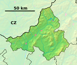 Location of Jablonka in the Trenčín Region  Jablonka, Myjava District (Slovakia) | |
| Wikimedia Commons: Jablonka | |
| Website: www.jablonka.sk | |
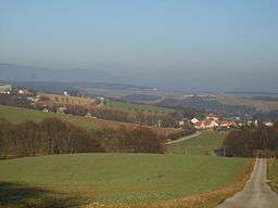
Jablonka is a village and municipality in the Myjava District in the Trenčín Region of West Slovakia. The name Jablonka literally translates as a 'small apple tree', which can be explained by the large number of apple trees in and around the village.
History
In historical records the village was first mentioned in 1955.
Geography
The municipality lies at an altitude of 290 metres and covers an area of 12.587 km². It has a population of about 516 people. The small villages in Jablonka consist of U maliarikovci, U usiiacovci and U michalickovci.
External links
This article is issued from
Wikipedia.
The text is licensed under Creative Commons - Attribution - Sharealike.
Additional terms may apply for the media files.